Nixon Gulch Topo Map Montana
To zoom in, hover over the map of Nixon Gulch
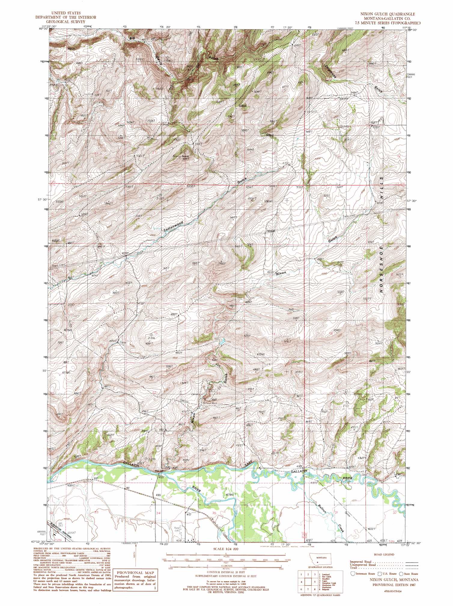
USGS Topo Quad 45111h3 - 1:24,000 scale
| Topo Map Name: | Nixon Gulch |
| USGS Topo Quad ID: | 45111h3 |
| Print Size: | ca. 21 1/4" wide x 27" high |
| Southeast Coordinates: | 45.875° N latitude / 111.25° W longitude |
| Map Center Coordinates: | 45.9375° N latitude / 111.3125° W longitude |
| U.S. State: | MT |
| Filename: | o45111h3.jpg |
| Download Map JPG Image: | Nixon Gulch topo map 1:24,000 scale |
| Map Type: | Topographic |
| Topo Series: | 7.5´ |
| Map Scale: | 1:24,000 |
| Source of Map Images: | United States Geological Survey (USGS) |
| Alternate Map Versions: |
Nixon Gulch MT 1987, updated 1988 Download PDF Buy paper map Nixon Gulch MT 2011 Download PDF Buy paper map Nixon Gulch MT 2014 Download PDF Buy paper map |
1:24,000 Topo Quads surrounding Nixon Gulch
Parker |
Toston |
Deer Park |
Sixmile Mountain |
Francis |
Plunket Lake |
Lombard |
Roy Gulch |
Maudlow |
Blacktail Mountain |
Three Forks |
Logan |
Nixon Gulch |
Horseshoe Creek |
Flathead Pass |
Three Forks Se |
Manhattan Sw |
Manhattan |
Belgrade |
Miser Creek |
Norris Ne |
Madison Plateau |
Anceney |
Bozeman Hot Springs |
Bozeman |
> Back to 45111e1 at 1:100,000 scale
> Back to 45110a1 at 1:250,000 scale
> Back to U.S. Topo Maps home
Nixon Gulch topo map: Gazetteer
Nixon Gulch: Bridges
Barton Bridge (historical) elevation 1267m 4156′Gallatin River Bridge elevation 1267m 4156′
Nixon Gulch: Mines
Horseshoe/Nixon Glch Mine elevation 1523m 4996′Nixon Gulch: Springs
02N03E32AD__01 Spring elevation 1269m 4163′02N03E33BA__01 Spring elevation 1271m 4169′
White Spring elevation 1576m 5170′
Nixon Gulch: Streams
Bullrun Creek elevation 1277m 4189′Camp Creek elevation 1280m 4199′
East Gallatin River elevation 1267m 4156′
Nixon Gulch: Valleys
Mixon Gulch elevation 1310m 4297′Nixon Gulch elevation 1268m 4160′
Nixon Gulch: Wells
02N03E25CB__01 Well elevation 1311m 4301′02N03E32DD__01 Well elevation 1282m 4206′
02N03E33DADD01 Well elevation 1274m 4179′
02N03E34CA__01 Well elevation 1269m 4163′
02N03E34DD__01 Well elevation 1286m 4219′
02N03E36AC__01 Well elevation 1280m 4199′
02N04E31CC__01 Well elevation 1285m 4215′
02N04E32AB__01 Well elevation 1289m 4229′
Nixon Gulch digital topo map on disk
Buy this Nixon Gulch topo map showing relief, roads, GPS coordinates and other geographical features, as a high-resolution digital map file on DVD: