Milligan Canyon Topo Map Montana
To zoom in, hover over the map of Milligan Canyon
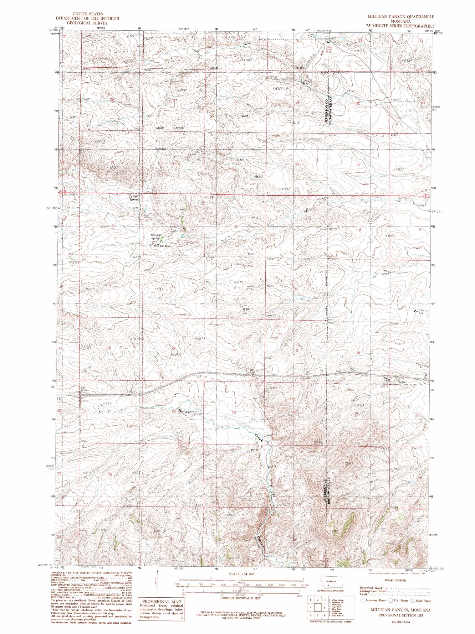
USGS Topo Quad 45111h6 - 1:24,000 scale
| Topo Map Name: | Milligan Canyon |
| USGS Topo Quad ID: | 45111h6 |
| Print Size: | ca. 21 1/4" wide x 27" high |
| Southeast Coordinates: | 45.875° N latitude / 111.625° W longitude |
| Map Center Coordinates: | 45.9375° N latitude / 111.6875° W longitude |
| U.S. State: | MT |
| Filename: | o45111h6.jpg |
| Download Map JPG Image: | Milligan Canyon topo map 1:24,000 scale |
| Map Type: | Topographic |
| Topo Series: | 7.5´ |
| Map Scale: | 1:24,000 |
| Source of Map Images: | United States Geological Survey (USGS) |
| Alternate Map Versions: |
Milligan Canyon MT 1987, updated 1987 Download PDF Buy paper map Milligan Canyon MT 2011 Download PDF Buy paper map Milligan Canyon MT 2014 Download PDF Buy paper map |
1:24,000 Topo Quads surrounding Milligan Canyon
Tacoma Park |
Devils Fence |
Radersburg |
Parker |
Toston |
Dunn Creek |
Willow Springs |
Radersburg Sw |
Plunket Lake |
Lombard |
Doherty Mountain |
Negro Hollow |
Milligan Canyon |
Three Forks |
Logan |
Jefferson Island |
Sappington |
Willow Creek |
Three Forks Se |
Manhattan Sw |
Pony |
Harrison |
Willow Creek Reservoir |
Norris Ne |
Madison Plateau |
> Back to 45111e1 at 1:100,000 scale
> Back to 45110a1 at 1:250,000 scale
> Back to U.S. Topo Maps home
Milligan Canyon topo map: Gazetteer
Milligan Canyon: Crossings
Interchange 267 elevation 1394m 4573′Milligan Canyon: Springs
Cowan Spring elevation 1456m 4776′Shoddy Springs elevation 1401m 4596′
Milligan Canyon: Wells
02N01W22ADDD01 Well elevation 1360m 4461′02N01W22DABA01 Well elevation 1365m 4478′
Milligan Canyon digital topo map on disk
Buy this Milligan Canyon topo map showing relief, roads, GPS coordinates and other geographical features, as a high-resolution digital map file on DVD: