Negro Hollow Topo Map Montana
To zoom in, hover over the map of Negro Hollow
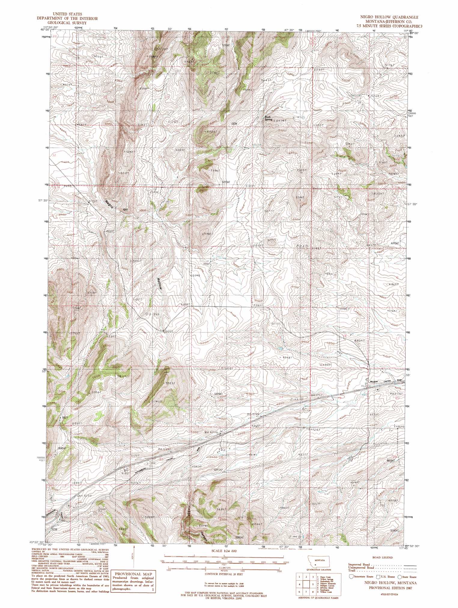
USGS Topo Quad 45111h7 - 1:24,000 scale
| Topo Map Name: | Negro Hollow |
| USGS Topo Quad ID: | 45111h7 |
| Print Size: | ca. 21 1/4" wide x 27" high |
| Southeast Coordinates: | 45.875° N latitude / 111.75° W longitude |
| Map Center Coordinates: | 45.9375° N latitude / 111.8125° W longitude |
| U.S. State: | MT |
| Filename: | o45111h7.jpg |
| Download Map JPG Image: | Negro Hollow topo map 1:24,000 scale |
| Map Type: | Topographic |
| Topo Series: | 7.5´ |
| Map Scale: | 1:24,000 |
| Source of Map Images: | United States Geological Survey (USGS) |
| Alternate Map Versions: |
Negro Hollow MT 1987, updated 1988 Download PDF Buy paper map Negro Hollow MT 2011 Download PDF Buy paper map Negro Hollow MT 2014 Download PDF Buy paper map |
1:24,000 Topo Quads surrounding Negro Hollow
Boulder East |
Tacoma Park |
Devils Fence |
Radersburg |
Parker |
Wilson Park |
Dunn Creek |
Willow Springs |
Radersburg Sw |
Plunket Lake |
Black Butte |
Doherty Mountain |
Negro Hollow |
Milligan Canyon |
Three Forks |
Whitehall |
Jefferson Island |
Sappington |
Willow Creek |
Three Forks Se |
Manhead Mountain |
Pony |
Harrison |
Willow Creek Reservoir |
Norris Ne |
> Back to 45111e1 at 1:100,000 scale
> Back to 45110a1 at 1:250,000 scale
> Back to U.S. Topo Maps home
Negro Hollow topo map: Gazetteer
Negro Hollow: Springs
Rock Spring elevation 1566m 5137′Negro Hollow: Valleys
Negro Hollow elevation 1364m 4475′Timber Canyon elevation 1467m 4812′
Negro Hollow: Wells
02N02W26ACCA01 Well elevation 1485m 4872′Negro Hollow digital topo map on disk
Buy this Negro Hollow topo map showing relief, roads, GPS coordinates and other geographical features, as a high-resolution digital map file on DVD: