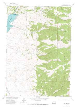
Ruby Dam Topo Map Montana
To zoom in, hover over the map of Ruby Dam
USGS Topo Quad 45112b1 - 1:24,000 scale
| Topo Map Name: | Ruby Dam |
| USGS Topo Quad ID: | 45112b1 |
| Print Size: | ca. 21 1/4" wide x 27" high |
| Southeast Coordinates: | 45.125° N latitude / 112° W longitude |
| Map Center Coordinates: | 45.1875° N latitude / 112.0625° W longitude |
| U.S. State: | MT |
| Filename: | o45112b1.jpg |
| Download Map JPG Image: | Ruby Dam topo map 1:24,000 scale |
| Map Type: | Topographic |
| Topo Series: | 7.5´ |
| Map Scale: | 1:24,000 |
| Source of Map Images: | United States Geological Survey (USGS) |
| Alternate Map Versions: |
Ruby Dam MT 1963, updated 1965 Download PDF Buy paper map Ruby Dam MT 1963, updated 1965 Download PDF Buy paper map Ruby Dam MT 1997, updated 2002 Download PDF Buy paper map Ruby Dam MT 2011 Download PDF Buy paper map Ruby Dam MT 2014 Download PDF Buy paper map |
| FStopo: | US Forest Service topo Ruby Dam is available: Download FStopo PDF Download FStopo TIF |
1:24,000 Topo Quads surrounding Ruby Dam
> Back to 45112a1 at 1:100,000 scale
> Back to 45112a1 at 1:250,000 scale
> Back to U.S. Topo Maps home
Ruby Dam topo map: Gazetteer
Ruby Dam: Canals
Calloway Ditch elevation 1704m 5590′Ruby Dam: Dams
Ruby Dam elevation 1645m 5396′Ruby Dam elevation 1647m 5403′
Ruby Dam: Mines
Barton Gulch Mine elevation 2055m 6742′Davey Creek Mine elevation 1845m 6053′
Ruby Dam: Reservoirs
Ruby River Reservoir elevation 1642m 5387′Ruby Dam: Streams
Davey Creek elevation 1653m 5423′Ruby Dam: Valleys
Barton Gulch elevation 1645m 5396′Dark Hollow elevation 1929m 6328′
Ruby Dam digital topo map on disk
Buy this Ruby Dam topo map showing relief, roads, GPS coordinates and other geographical features, as a high-resolution digital map file on DVD:


