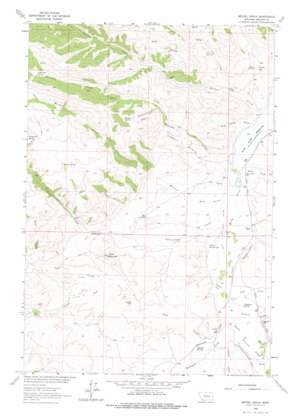
Metzel Ranch Topo Map Montana
To zoom in, hover over the map of Metzel Ranch
USGS Topo Quad 45112b2 - 1:24,000 scale
| Topo Map Name: | Metzel Ranch |
| USGS Topo Quad ID: | 45112b2 |
| Print Size: | ca. 21 1/4" wide x 27" high |
| Southeast Coordinates: | 45.125° N latitude / 112.125° W longitude |
| Map Center Coordinates: | 45.1875° N latitude / 112.1875° W longitude |
| U.S. State: | MT |
| Filename: | o45112b2.jpg |
| Download Map JPG Image: | Metzel Ranch topo map 1:24,000 scale |
| Map Type: | Topographic |
| Topo Series: | 7.5´ |
| Map Scale: | 1:24,000 |
| Source of Map Images: | United States Geological Survey (USGS) |
| Alternate Map Versions: |
Metzel Ranch MT 1963, updated 1964 Download PDF Buy paper map Metzel Ranch MT 1963, updated 1975 Download PDF Buy paper map Metzel Ranch MT 2011 Download PDF Buy paper map Metzel Ranch MT 2014 Download PDF Buy paper map |
1:24,000 Topo Quads surrounding Metzel Ranch
> Back to 45112a1 at 1:100,000 scale
> Back to 45112a1 at 1:250,000 scale
> Back to U.S. Topo Maps home
Metzel Ranch topo map: Gazetteer
Metzel Ranch: Basins
Antelope Basin elevation 1991m 6532′Fossil Basin elevation 1779m 5836′
Metzel Ranch: Canals
Metzel West Side Ditch elevation 1664m 5459′Pioneer Ditch elevation 1673m 5488′
Metzel Ranch: Cliffs
Buffalo Jumps elevation 1708m 5603′Metzel Ranch: Lakes
Trudau Lake elevation 1720m 5643′Metzel Ranch: Mines
Kelly Hill Mine elevation 1685m 5528′Peterson Creek Mine elevation 1832m 6010′
Metzel Ranch: Populated Places
Ball Place elevation 1697m 5567′Burdick Place elevation 1812m 5944′
Campbell Place elevation 1755m 5757′
Kingrey Place elevation 1699m 5574′
Metzel Ranch: Post Offices
Puller Springs Post Office (historical) elevation 1661m 5449′Metzel Ranch: Springs
07S04W31CDDC01 Spring elevation 1664m 5459′08S05W01AACC01 Spring elevation 1665m 5462′
08S05W01AACC02 Spring elevation 1665m 5462′
Antelope Spring elevation 2094m 6870′
Barrel Springs elevation 2145m 7037′
Caldwell Springs elevation 1706m 5597′
Fitzpatrick Spring elevation 2163m 7096′
Lightning Spring elevation 2294m 7526′
Mud Spring elevation 1765m 5790′
Puller Hot Springs elevation 1673m 5488′
Thompson Spring elevation 1684m 5524′
Warm Springs elevation 1733m 5685′
Metzel Ranch: Streams
Broadhead Slough elevation 1671m 5482′Brunzell Slough elevation 1686m 5531′
Bum Creek elevation 1875m 6151′
Cottonwood Creek elevation 1663m 5456′
Garden Creek elevation 1645m 5396′
Idaho Creek elevation 1647m 5403′
Jack Creek elevation 1677m 5501′
Jasmine Creek elevation 1678m 5505′
Mormon Creek elevation 1651m 5416′
Peterson Creek elevation 1645m 5396′
Sage Creek elevation 1690m 5544′
South Fork Sage Creek elevation 1768m 5800′
Spring Creek elevation 1692m 5551′
Sweetwater Creek elevation 1683m 5521′
Metzel Ranch: Summits
Table Mountain elevation 1910m 6266′Metzel Ranch: Valleys
Peschi Draw elevation 1705m 5593′Tucker Gulch elevation 1645m 5396′
Metzel Ranch: Wells
07S04W31DCB_01 Well elevation 1665m 5462′08S04W06ABBA01 Well elevation 1678m 5505′
Metzel Ranch digital topo map on disk
Buy this Metzel Ranch topo map showing relief, roads, GPS coordinates and other geographical features, as a high-resolution digital map file on DVD:


