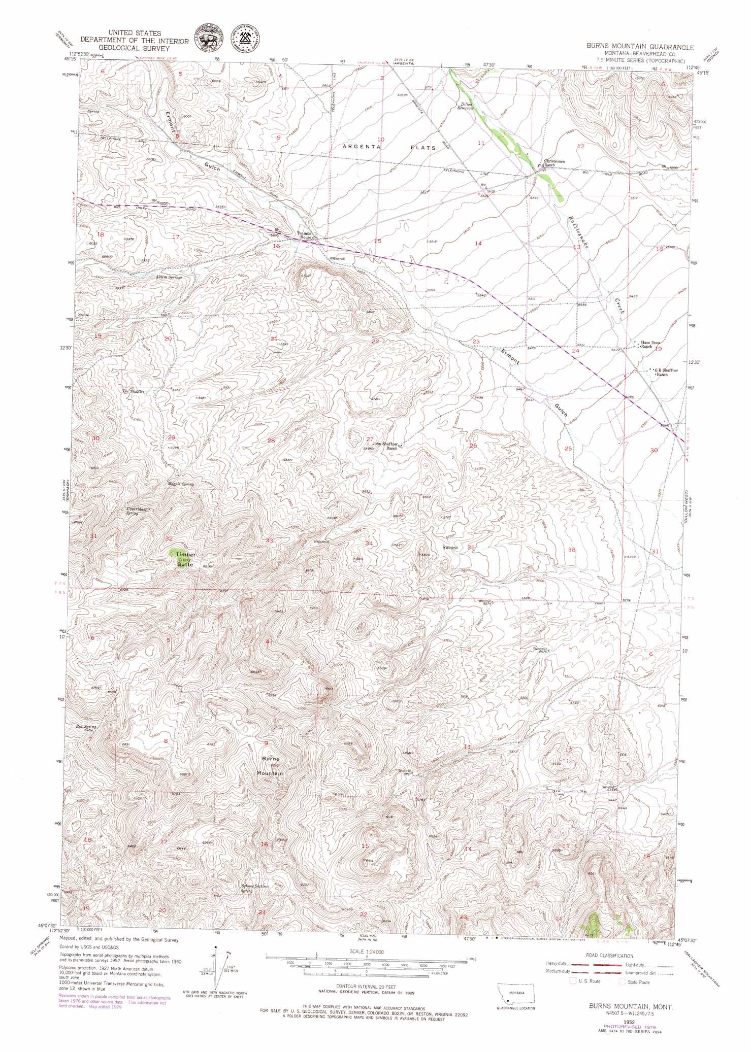
Burns Mountain Topo Map Montana
To zoom in, hover over the map of Burns Mountain
USGS Topo Quad 45112b7 - 1:24,000 scale
| Topo Map Name: | Burns Mountain |
| USGS Topo Quad ID: | 45112b7 |
| Print Size: | ca. 21 1/4" wide x 27" high |
| Southeast Coordinates: | 45.125° N latitude / 112.75° W longitude |
| Map Center Coordinates: | 45.1875° N latitude / 112.8125° W longitude |
| U.S. State: | MT |
| Filename: | o45112b7.jpg |
| Download Map JPG Image: | Burns Mountain topo map 1:24,000 scale |
| Map Type: | Topographic |
| Topo Series: | 7.5´ |
| Map Scale: | 1:24,000 |
| Source of Map Images: | United States Geological Survey (USGS) |
| Alternate Map Versions: |
Burns Mountain MT 1952, updated 1954 Download PDF Buy paper map Burns Mountain MT 1952, updated 1969 Download PDF Buy paper map Burns Mountain MT 1952, updated 1979 Download PDF Buy paper map Burns Mountain MT 2011 Download PDF Buy paper map Burns Mountain MT 2014 Download PDF Buy paper map |
1:24,000 Topo Quads surrounding Burns Mountain
Elkhorn Hot Springs |
Torrey Mountain |
Twin Adams Mountain |
Glen |
Block Mountain |
Polaris |
Ermont |
Argenta |
Bond |
Glen Se |
Mill Point |
Bannack |
Burns Mountain |
Dillon West |
Dillon East |
Grant |
Eli Spring |
Dalys |
Gallagher Mountain |
Ashbough Canyon |
Hansen Ranch |
Garfield Canyon |
Red Rock |
Monument Hill |
Beech Creek |
> Back to 45112a1 at 1:100,000 scale
> Back to 45112a1 at 1:250,000 scale
> Back to U.S. Topo Maps home
Burns Mountain topo map: Gazetteer
Burns Mountain: Post Offices
Morrison Post Office (historical) elevation 1720m 5643′Burns Mountain: Reservoirs
Dillon Reservoir elevation 1733m 5685′Burns Mountain: Springs
Albers Springs elevation 1773m 5816′Magpie Spring elevation 1864m 6115′
Red Spring elevation 1955m 6414′
School Section Spring elevation 1853m 6079′
The Puddles elevation 1847m 6059′
Upper Magpie Spring elevation 1918m 6292′
Burns Mountain: Summits
Burns Mountain elevation 2056m 6745′Timber Butte elevation 2050m 6725′
Burns Mountain: Wells
07S10W15CBCC01 Well elevation 1715m 5626′07S10W22AAD_01 Well elevation 1679m 5508′
07S10W24BCCA01 Well elevation 1670m 5479′
07S10W24BCCA02 Well elevation 1670m 5479′
07S10W24BDB_01 Well elevation 1672m 5485′
Burns Mountain digital topo map on disk
Buy this Burns Mountain topo map showing relief, roads, GPS coordinates and other geographical features, as a high-resolution digital map file on DVD: