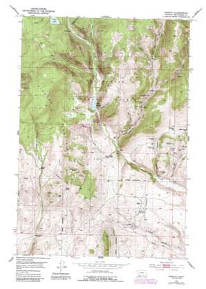
Ermont Topo Map Montana
To zoom in, hover over the map of Ermont
USGS Topo Quad 45112c8 - 1:24,000 scale
| Topo Map Name: | Ermont |
| USGS Topo Quad ID: | 45112c8 |
| Print Size: | ca. 21 1/4" wide x 27" high |
| Southeast Coordinates: | 45.25° N latitude / 112.875° W longitude |
| Map Center Coordinates: | 45.3125° N latitude / 112.9375° W longitude |
| U.S. State: | MT |
| Filename: | o45112c8.jpg |
| Download Map JPG Image: | Ermont topo map 1:24,000 scale |
| Map Type: | Topographic |
| Topo Series: | 7.5´ |
| Map Scale: | 1:24,000 |
| Source of Map Images: | United States Geological Survey (USGS) |
| Alternate Map Versions: |
Ermont MT 1952, updated 1954 Download PDF Buy paper map Ermont MT 1952, updated 1975 Download PDF Buy paper map Ermont MT 1952, updated 1984 Download PDF Buy paper map Ermont MT 1952, updated 1989 Download PDF Buy paper map Ermont MT 1997, updated 2002 Download PDF Buy paper map Ermont MT 2011 Download PDF Buy paper map Ermont MT 2014 Download PDF Buy paper map |
| FStopo: | US Forest Service topo Ermont is available: Download FStopo PDF Download FStopo TIF |
1:24,000 Topo Quads surrounding Ermont
> Back to 45112a1 at 1:100,000 scale
> Back to 45112a1 at 1:250,000 scale
> Back to U.S. Topo Maps home
Ermont topo map: Gazetteer
Ermont: Bars
The Sandbar elevation 2263m 7424′Ermont: Basins
Kearns Basin elevation 2209m 7247′Ermont: Dams
Estler Lake Dam elevation 2397m 7864′Kelly Dam elevation 2137m 7011′
Ermont: Mines
Argenta Mine elevation 2154m 7066′Badger Mine elevation 2023m 6637′
Badger Mine elevation 2055m 6742′
Carbonate Mine elevation 2169m 7116′
Comstock Mine elevation 2012m 6601′
Cross Mine elevation 2184m 7165′
Cross Mine elevation 2166m 7106′
Discovery Mine elevation 2291m 7516′
Discovery Mine elevation 2149m 7050′
Dutchman Mine elevation 2111m 6925′
East Ermont Mine elevation 1971m 6466′
Ermont Mill elevation 1958m 6423′
Ermont Number 19 Mine elevation 2008m 6587′
Ermont Number 19 Mine elevation 1958m 6423′
Ermont Number 2 Mine elevation 1949m 6394′
Florence Mine elevation 2052m 6732′
French Creek Mine elevation 2059m 6755′
Gold Finch Mine elevation 2052m 6732′
Golden Era Mine elevation 2166m 7106′
Golden Era Mine elevation 2182m 7158′
Goldfinch Mine elevation 2077m 6814′
Goodview Mine elevation 2103m 6899′
Goodview Mine elevation 2103m 6899′
Ground Hog Mine elevation 2079m 6820′
Jack Mine elevation 2093m 6866′
Legal Tender Mine elevation 2003m 6571′
Legal Tender Mine elevation 2010m 6594′
Madison Mine elevation 2187m 7175′
May Day Mine elevation 2148m 7047′
May Day Mine elevation 2148m 7047′
Midnight Mine elevation 2142m 7027′
NE Section 24 Mine elevation 2072m 6797′
NW Ermont Mine elevation 1958m 6423′
Park Mine elevation 2236m 7335′
Park Mine elevation 2251m 7385′
Pay Day Mine elevation 2176m 7139′
Pilon Ranch Mine elevation 2025m 6643′
Rena Mine elevation 2153m 7063′
SE Section 21 Mine elevation 2147m 7043′
Silver Rule Mine elevation 2184m 7165′
Silver Rule Mine elevation 2174m 7132′
Starlight Mine elevation 2000m 6561′
Stinson Mine elevation 2059m 6755′
Stinson Mine elevation 2104m 6902′
Storm King Mine elevation 2145m 7037′
Sylvia Mine elevation 2111m 6925′
Trout Creek Mine elevation 2381m 7811′
Watson Gulch Mine elevation 2469m 8100′
Yellow Band Mine elevation 2187m 7175′
Yellow Band Mine elevation 2251m 7385′
Ermont: Populated Places
Ermont Mill elevation 1963m 6440′Ermont: Reservoirs
Estler Lake elevation 2397m 7864′Kelley Reservoir elevation 2137m 7011′
Kelly Reservoir elevation 2137m 7011′
Ermont: Springs
Argenta Spring elevation 2113m 6932′Best Spring elevation 2016m 6614′
Taylor Spring elevation 2265m 7431′
Ermont: Streams
Cat Creek elevation 2162m 7093′French Creek elevation 1988m 6522′
Kearns Creek elevation 1988m 6522′
McMannis Creek elevation 2229m 7312′
Trout Creek elevation 2177m 7142′
Ermont: Summits
Red Butte elevation 2269m 7444′Ermont: Valleys
Bear Gulch elevation 2183m 7162′Clarks Canyon elevation 1935m 6348′
Kelley Gulch elevation 2135m 7004′
Little Bear Gulch elevation 2206m 7237′
Long Stapleton Gulch elevation 1922m 6305′
Red Gulch elevation 2061m 6761′
Sawlog Gulch elevation 2281m 7483′
Watson Gulch elevation 2260m 7414′
Watt Gulch elevation 2348m 7703′
Ermont digital topo map on disk
Buy this Ermont topo map showing relief, roads, GPS coordinates and other geographical features, as a high-resolution digital map file on DVD:


