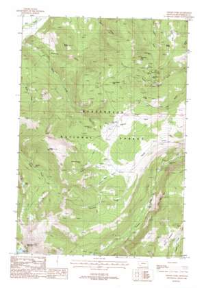
Vipond Park Topo Map Montana
To zoom in, hover over the map of Vipond Park
USGS Topo Quad 45112f8 - 1:24,000 scale
| Topo Map Name: | Vipond Park |
| USGS Topo Quad ID: | 45112f8 |
| Print Size: | ca. 21 1/4" wide x 27" high |
| Southeast Coordinates: | 45.625° N latitude / 112.875° W longitude |
| Map Center Coordinates: | 45.6875° N latitude / 112.9375° W longitude |
| U.S. State: | MT |
| Filename: | o45112f8.jpg |
| Download Map JPG Image: | Vipond Park topo map 1:24,000 scale |
| Map Type: | Topographic |
| Topo Series: | 7.5´ |
| Map Scale: | 1:24,000 |
| Source of Map Images: | United States Geological Survey (USGS) |
| Alternate Map Versions: |
Vipond Park MT 1988, updated 1988 Download PDF Buy paper map Vipond Park MT 1997, updated 2002 Download PDF Buy paper map Vipond Park MT 2011 Download PDF Buy paper map Vipond Park MT 2014 Download PDF Buy paper map |
| FStopo: | US Forest Service topo Vipond Park is available: Download FStopo PDF Download FStopo TIF |
1:24,000 Topo Quads surrounding Vipond Park
> Back to 45112e1 at 1:100,000 scale
> Back to 45112a1 at 1:250,000 scale
> Back to U.S. Topo Maps home
Vipond Park topo map: Gazetteer
Vipond Park: Flats
Knoby Park elevation 2261m 7417′Vipond Park elevation 2501m 8205′
Yanks Pasture elevation 2248m 7375′
Vipond Park: Lakes
Black Lion Lake elevation 2684m 8805′Bobs Lake elevation 2607m 8553′
Vipond Park: Mines
Blue Bell Mine elevation 2323m 7621′Daisy Vein Mine elevation 2398m 7867′
Gray Jockey Mine elevation 2437m 7995′
Gray Jockey Mine elevation 2439m 8001′
Great Western Mine elevation 2354m 7723′
Knoby Mine elevation 2371m 7778′
Log Cabin Lode elevation 2179m 7148′
Log Cabin Mine elevation 2268m 7440′
Lone Pine Mine elevation 2271m 7450′
Marmot Mine elevation 2563m 8408′
Mewonitoc Mine elevation 2473m 8113′
Monte Cristo Mine elevation 2309m 7575′
Monte Cristo Mine elevation 2300m 7545′
Old Faithful Mine elevation 2335m 7660′
Polaris Mine elevation 2585m 8480′
Queen of the Hills Mine elevation 2559m 8395′
Queen of the Hills Mine elevation 2544m 8346′
SW NE Section 3 Mine elevation 2253m 7391′
Tuxedo Mine elevation 2565m 8415′
Vega Mine elevation 2547m 8356′
West Lone Pine Mine elevation 2458m 8064′
Vipond Park: Post Offices
Burnt Pine Post Office (historical) elevation 2119m 6952′Vipond Post Office (historical) elevation 2465m 8087′
Vipond Park: Springs
Knoby Spring elevation 2308m 7572′Vipond Park: Summits
Black Lion Mountain elevation 3167m 10390′Boner Knob elevation 2316m 7598′
Gray Jockey Peak elevation 2621m 8599′
Ponsonby Peak elevation 2491m 8172′
Quartz Hill elevation 2464m 8083′
Sheep Mountain elevation 2917m 9570′
Vipond Park: Valleys
Buffalo Head Gulch elevation 2347m 7700′Cannivan Gulch elevation 2356m 7729′
Echo Gulch elevation 2166m 7106′
Mammoth Gulch elevation 1831m 6007′
Queens Gulch elevation 2347m 7700′
Vipond Park digital topo map on disk
Buy this Vipond Park topo map showing relief, roads, GPS coordinates and other geographical features, as a high-resolution digital map file on DVD:


