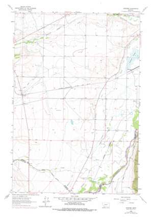
Vendome Topo Map Montana
To zoom in, hover over the map of Vendome
USGS Topo Quad 45112g2 - 1:24,000 scale
| Topo Map Name: | Vendome |
| USGS Topo Quad ID: | 45112g2 |
| Print Size: | ca. 21 1/4" wide x 27" high |
| Southeast Coordinates: | 45.75° N latitude / 112.125° W longitude |
| Map Center Coordinates: | 45.8125° N latitude / 112.1875° W longitude |
| U.S. State: | MT |
| Filename: | o45112g2.jpg |
| Download Map JPG Image: | Vendome topo map 1:24,000 scale |
| Map Type: | Topographic |
| Topo Series: | 7.5´ |
| Map Scale: | 1:24,000 |
| Source of Map Images: | United States Geological Survey (USGS) |
| Alternate Map Versions: |
Vendome MT 1963, updated 1966 Download PDF Buy paper map Vendome MT 1963, updated 1978 Download PDF Buy paper map Vendome MT 1996, updated 1998 Download PDF Buy paper map Vendome MT 2011 Download PDF Buy paper map Vendome MT 2014 Download PDF Buy paper map |
| FStopo: | US Forest Service topo Vendome is available: Download FStopo PDF Download FStopo TIF |
1:24,000 Topo Quads surrounding Vendome
> Back to 45112e1 at 1:100,000 scale
> Back to 45112a1 at 1:250,000 scale
> Back to U.S. Topo Maps home
Vendome topo map: Gazetteer
Vendome: Canals
Delmoe Ditch elevation 1368m 4488′Jefferson Canal elevation 1345m 4412′
Pleasant Valley Ditch elevation 1342m 4402′
Vendome: Mines
NE SW Section 29 Mine elevation 1403m 4603′SW NW Section 16 Mine elevation 1461m 4793′
Vendome: Populated Places
Piedmont elevation 1330m 4363′Renova elevation 1334m 4376′
Vendome elevation 1477m 4845′
Vendome: Post Offices
Fish Creek Post Office (historical) elevation 1357m 4452′Hope Post Office (historical) elevation 1342m 4402′
Piedmont Post Office (historical) elevation 1330m 4363′
Renova Post Office (historical) elevation 1334m 4376′
Vendome: Springs
01N04W32DBC_01 Spring elevation 1336m 4383′Vendome: Swamps
Piedmont Swamp elevation 1327m 4353′Vendome: Valleys
Cedar Gulch elevation 1427m 4681′Perry Canyon elevation 1396m 4580′
Vendome: Wells
01N03W03DAA_01 Well elevation 1404m 4606′01N04W07BACA01 Well elevation 1397m 4583′
01N05W03CCAC01 Well elevation 1395m 4576′
01N05W22AAAA01 Well elevation 1398m 4586′
01N05W24DCCA01 Well elevation 1365m 4478′
01S04W06DDBC01 Well elevation 1353m 4438′
01S05W14BBBC01 Well elevation 1373m 4504′
Vendome digital topo map on disk
Buy this Vendome topo map showing relief, roads, GPS coordinates and other geographical features, as a high-resolution digital map file on DVD:


