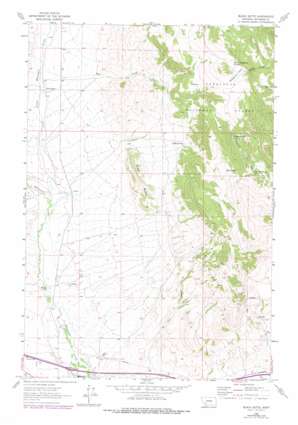
Black Butte Topo Map Montana
To zoom in, hover over the map of Black Butte
USGS Topo Quad 45112h1 - 1:24,000 scale
| Topo Map Name: | Black Butte |
| USGS Topo Quad ID: | 45112h1 |
| Print Size: | ca. 21 1/4" wide x 27" high |
| Southeast Coordinates: | 45.875° N latitude / 112° W longitude |
| Map Center Coordinates: | 45.9375° N latitude / 112.0625° W longitude |
| U.S. State: | MT |
| Filename: | o45112h1.jpg |
| Download Map JPG Image: | Black Butte topo map 1:24,000 scale |
| Map Type: | Topographic |
| Topo Series: | 7.5´ |
| Map Scale: | 1:24,000 |
| Source of Map Images: | United States Geological Survey (USGS) |
| Alternate Map Versions: |
Black Butte MT 1963, updated 1966 Download PDF Buy paper map Black Butte MT 1963, updated 1977 Download PDF Buy paper map Black Butte MT 1963, updated 1978 Download PDF Buy paper map Black Butte MT 1996, updated 1998 Download PDF Buy paper map Black Butte MT 2011 Download PDF Buy paper map Black Butte MT 2014 Download PDF Buy paper map |
| FStopo: | US Forest Service topo Black Butte is available: Download FStopo PDF Download FStopo TIF |
1:24,000 Topo Quads surrounding Black Butte
> Back to 45112e1 at 1:100,000 scale
> Back to 45112a1 at 1:250,000 scale
> Back to U.S. Topo Maps home
Black Butte topo map: Gazetteer
Black Butte: Airports
Jefco Skypark Airport elevation 1362m 4468′Black Butte: Canals
Whitetail Ditch elevation 1340m 4396′Black Butte: Crossings
Interchange 249 elevation 1336m 4383′Black Butte: Flats
Houghton Park elevation 2165m 7103′Black Butte: Mines
Carbonate Mine elevation 1685m 5528′Examiner Mine elevation 1743m 5718′
Gem Mine elevation 1703m 5587′
Golden Mine elevation 1827m 5994′
Iron Side Mine elevation 1710m 5610′
Luck Heat Mine elevation 1756m 5761′
Minerva Mine elevation 1708m 5603′
NW NE Section 13 Mine elevation 1803m 5915′
Parrott Mine elevation 1743m 5718′
Perhaps Mine elevation 1901m 6236′
SE NE Section 24 Mine elevation 1749m 5738′
SE NW Section 13 Mine elevation 1710m 5610′
SE SE Section 13 Mine elevation 1729m 5672′
SE SW Section 12 Mine elevation 1679m 5508′
Sunlight Mine elevation 1659m 5442′
SW SW Section 18 Mine elevation 1758m 5767′
Black Butte: Pillars
Sheep Rock elevation 1656m 5433′Black Butte: Populated Places
Sunlight elevation 1685m 5528′Black Butte: Springs
Conrow Spring Number One elevation 1814m 5951′Conrow Spring Number Two elevation 1991m 6532′
Mud Spring elevation 1958m 6423′
South Cottonwood Spring elevation 2236m 7335′
Tebay Spring elevation 1819m 5967′
Black Butte: Streams
Fitz Creek elevation 1426m 4678′Little Whitetail Creek elevation 1379m 4524′
Black Butte: Summits
Black Butte elevation 1726m 5662′Black Butte: Valleys
Saint Paul Gulch elevation 1380m 4527′Black Butte: Wells
02N04W04DCCC01 Well elevation 1415m 4642′Black Butte digital topo map on disk
Buy this Black Butte topo map showing relief, roads, GPS coordinates and other geographical features, as a high-resolution digital map file on DVD:


