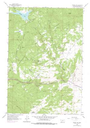
Delmoe Lake Topo Map Montana
To zoom in, hover over the map of Delmoe Lake
USGS Topo Quad 45112h3 - 1:24,000 scale
| Topo Map Name: | Delmoe Lake |
| USGS Topo Quad ID: | 45112h3 |
| Print Size: | ca. 21 1/4" wide x 27" high |
| Southeast Coordinates: | 45.875° N latitude / 112.25° W longitude |
| Map Center Coordinates: | 45.9375° N latitude / 112.3125° W longitude |
| U.S. State: | MT |
| Filename: | o45112h3.jpg |
| Download Map JPG Image: | Delmoe Lake topo map 1:24,000 scale |
| Map Type: | Topographic |
| Topo Series: | 7.5´ |
| Map Scale: | 1:24,000 |
| Source of Map Images: | United States Geological Survey (USGS) |
| Alternate Map Versions: |
Delmoe Lake MT 1963, updated 1966 Download PDF Buy paper map Delmoe Lake MT 1963, updated 1978 Download PDF Buy paper map Delmoe Lake MT 1996, updated 1998 Download PDF Buy paper map Delmoe Lake MT 2011 Download PDF Buy paper map Delmoe Lake MT 2014 Download PDF Buy paper map |
| FStopo: | US Forest Service topo Delmoe Lake is available: Download FStopo PDF Download FStopo TIF |
1:24,000 Topo Quads surrounding Delmoe Lake
> Back to 45112e1 at 1:100,000 scale
> Back to 45112a1 at 1:250,000 scale
> Back to U.S. Topo Maps home
Delmoe Lake topo map: Gazetteer
Delmoe Lake: Dams
Delmoe Lake Dam elevation 1861m 6105′Delmoe Lake: Flats
Coyote Flat elevation 1884m 6181′Delmoe Park elevation 1902m 6240′
Hatcher Flat elevation 1876m 6154′
Spire Rock Flats elevation 1709m 5606′
Delmoe Lake: Mines
Big Chief Mine elevation 2085m 6840′Finn Cabin Mine elevation 1820m 5971′
Humbolt Mine elevation 1969m 6459′
King Mine elevation 1989m 6525′
King Mine elevation 1998m 6555′
Legget Hill Mine elevation 2024m 6640′
Marsh Mine elevation 1731m 5679′
Marsh Mine elevation 1800m 5905′
NE NW Section 36 Mine elevation 1914m 6279′
NE SW Section 36 Mine elevation 1791m 5875′
NE SW Section 9 Mine elevation 1919m 6295′
SE SE Section 18 Mine elevation 1505m 4937′
SE SW Section 5 Mine elevation 1671m 5482′
Silver Queen Mine elevation 1729m 5672′
Silver Queen Mine elevation 1745m 5725′
Spire Rock Mine elevation 1705m 5593′
Suicide Cabin Mine elevation 1868m 6128′
SW SE Section 18 Mine elevation 1486m 4875′
SW SW Section 36 Mine elevation 1700m 5577′
SW SW Section 9 Mine elevation 1933m 6341′
Welch Quarry elevation 1833m 6013′
Delmoe Lake: Populated Places
Pappas Place elevation 1976m 6482′Paul Place elevation 1853m 6079′
Welch elevation 1741m 5711′
Delmoe Lake: Post Offices
Welch Post Office (historical) elevation 1741m 5711′Delmoe Lake: Reservoirs
Delmoe Lake elevation 1859m 6099′Delmoe Lake: Springs
Coyote Flat Spring elevation 1864m 6115′Pole Canyon Spring elevation 1864m 6115′
Delmoe Lake: Streams
Beefstraight Creek elevation 1582m 5190′Dry Creek elevation 1424m 4671′
Halfway Creek elevation 1571m 5154′
Haney Creek elevation 1859m 6099′
Hartman Creek elevation 1622m 5321′
Homestake Creek elevation 1477m 4845′
International Creek elevation 1863m 6112′
Moose Creek elevation 1807m 5928′
O'Neil Creek elevation 1859m 6099′
Pappas Creek elevation 1750m 5741′
Delmoe Lake: Summits
Bald Mountain elevation 2012m 6601′Black Sheep Mountain elevation 2098m 6883′
Legget Hill elevation 2097m 6879′
McClusky Mountain elevation 2481m 8139′
Pipestone Rock elevation 1853m 6079′
Spire Rock elevation 1829m 6000′
Delmoe Lake: Valleys
Pole Canyon elevation 1439m 4721′Whiskey Gulch elevation 1458m 4783′
Delmoe Lake digital topo map on disk
Buy this Delmoe Lake topo map showing relief, roads, GPS coordinates and other geographical features, as a high-resolution digital map file on DVD:


