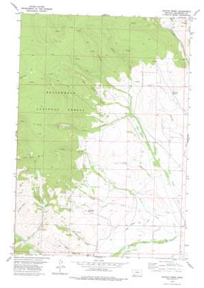
Coyote Creek Topo Map Montana
To zoom in, hover over the map of Coyote Creek
USGS Topo Quad 45113a3 - 1:24,000 scale
| Topo Map Name: | Coyote Creek |
| USGS Topo Quad ID: | 45113a3 |
| Print Size: | ca. 21 1/4" wide x 27" high |
| Southeast Coordinates: | 45° N latitude / 113.25° W longitude |
| Map Center Coordinates: | 45.0625° N latitude / 113.3125° W longitude |
| U.S. State: | MT |
| Filename: | o45113a3.jpg |
| Download Map JPG Image: | Coyote Creek topo map 1:24,000 scale |
| Map Type: | Topographic |
| Topo Series: | 7.5´ |
| Map Scale: | 1:24,000 |
| Source of Map Images: | United States Geological Survey (USGS) |
| Alternate Map Versions: |
Coyote Creek MT 1978, updated 1979 Download PDF Buy paper map Coyote Creek MT 1997, updated 2002 Download PDF Buy paper map Coyote Creek MT 2011 Download PDF Buy paper map Coyote Creek MT 2014 Download PDF Buy paper map |
| FStopo: | US Forest Service topo Coyote Creek is available: Download FStopo PDF Download FStopo TIF |
1:24,000 Topo Quads surrounding Coyote Creek
> Back to 45113a1 at 1:100,000 scale
> Back to 45112a1 at 1:250,000 scale
> Back to U.S. Topo Maps home
Coyote Creek topo map: Gazetteer
Coyote Creek: Canals
Lower Bloody Dick Ditch elevation 1901m 6236′Coyote Creek: Flats
Poverty Flats elevation 1982m 6502′Coyote Creek: Mines
Jung Fraction Mine elevation 2196m 7204′Monument Mine elevation 2013m 6604′
Moument Mine elevation 2008m 6587′
NE NE Section 4 Mine elevation 2112m 6929′
South Fork Roberts Gulch Mine elevation 2002m 6568′
Sunshine Mine elevation 2188m 7178′
Coyote Creek: Springs
Houlihan Springs elevation 2135m 7004′Coyote Creek: Streams
Frog Creek elevation 2027m 6650′Grimes Creek elevation 1866m 6122′
Jensen Creek elevation 1998m 6555′
Lodgepole Creek elevation 2106m 6909′
Station Creek elevation 1899m 6230′
West Coyote Creek elevation 2065m 6774′
Coyote Creek: Valleys
Big Hollow elevation 1974m 6476′Roberts Gulch elevation 1932m 6338′
Coyote Creek: Wells
09S14W25DDCB01 Well elevation 1877m 6158′09S14W25DDCC01 Well elevation 1875m 6151′
Coyote Creek digital topo map on disk
Buy this Coyote Creek topo map showing relief, roads, GPS coordinates and other geographical features, as a high-resolution digital map file on DVD:


