Peterson Lake Topo Map Montana
To zoom in, hover over the map of Peterson Lake
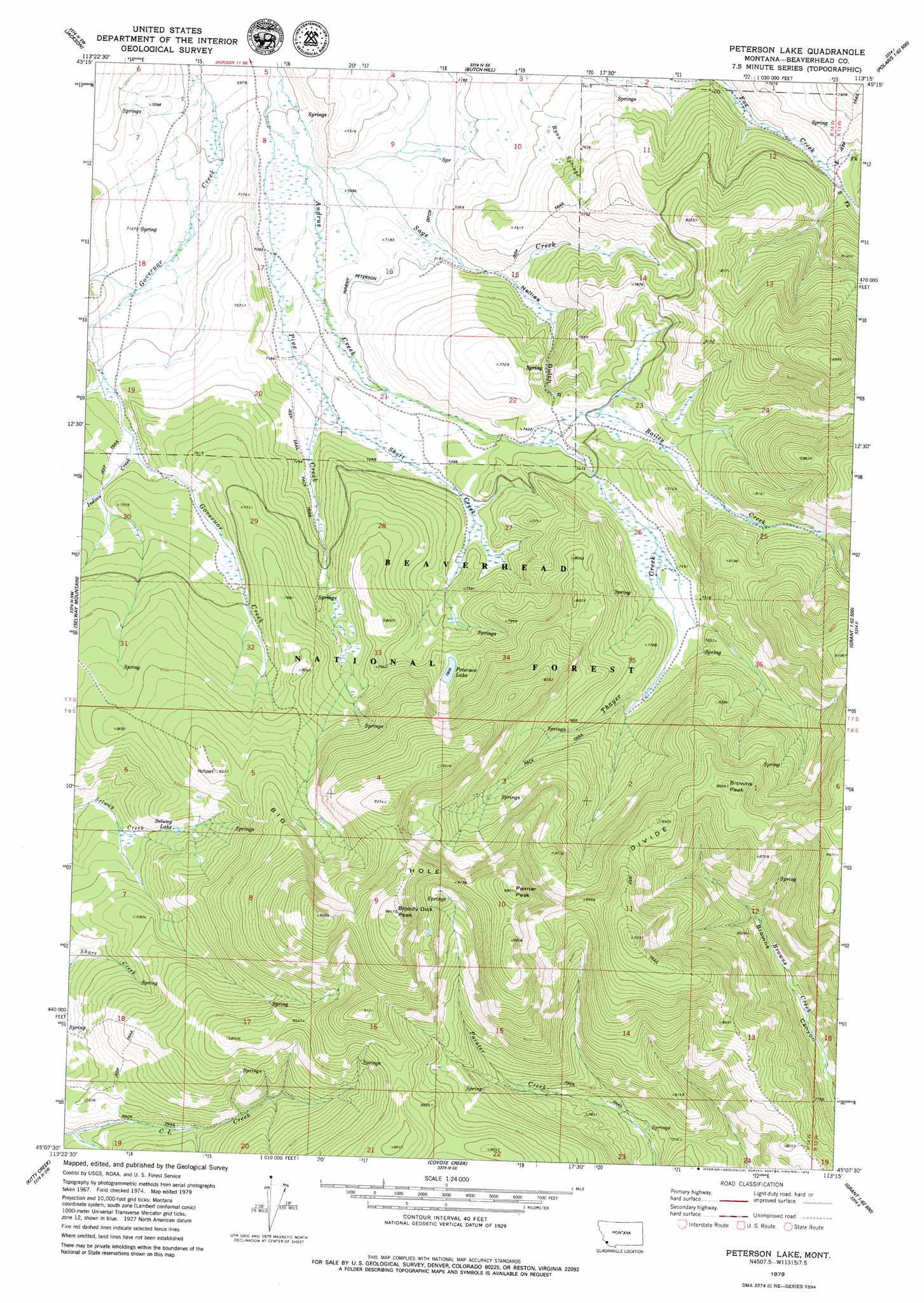
USGS Topo Quad 45113b3 - 1:24,000 scale
| Topo Map Name: | Peterson Lake |
| USGS Topo Quad ID: | 45113b3 |
| Print Size: | ca. 21 1/4" wide x 27" high |
| Southeast Coordinates: | 45.125° N latitude / 113.25° W longitude |
| Map Center Coordinates: | 45.1875° N latitude / 113.3125° W longitude |
| U.S. State: | MT |
| Filename: | o45113b3.jpg |
| Download Map JPG Image: | Peterson Lake topo map 1:24,000 scale |
| Map Type: | Topographic |
| Topo Series: | 7.5´ |
| Map Scale: | 1:24,000 |
| Source of Map Images: | United States Geological Survey (USGS) |
| Alternate Map Versions: |
Peterson Lake MT 1997, updated 2002 Download PDF Buy paper map Peterson Lake MT 2011 Download PDF Buy paper map Peterson Lake MT 2014 Download PDF Buy paper map |
| FStopo: | US Forest Service topo Peterson Lake is available: Download FStopo PDF Download FStopo TIF |
1:24,000 Topo Quads surrounding Peterson Lake
Ajax Ranch |
Fox Gulch |
Jackson Hill |
Maverick Mountain |
Elkhorn Hot Springs |
Miner Lake |
Jackson |
Butch Hill |
Tash Peak |
Polaris |
Goldstone Pass |
Selway Mountain |
Peterson Lake |
Brays Canyon |
Mill Point |
Goldstone Mountain |
Kitty Creek |
Coyote Creek |
Bachelor Mountain |
Grant |
Agency Creek |
Lemhi Pass |
Everson Creek |
Jeff Davis Peak |
Hansen Ranch |
> Back to 45113a1 at 1:100,000 scale
> Back to 45112a1 at 1:250,000 scale
> Back to U.S. Topo Maps home
Peterson Lake topo map: Gazetteer
Peterson Lake: Canals
Inabnit Peterson Ditch elevation 2187m 7175′Peterson Lake: Lakes
Peterson Lake elevation 2381m 7811′Selway Lake elevation 2340m 7677′
Peterson Lake: Springs
Ryan Springs elevation 2293m 7522′Peterson Lake: Streams
Bailey Creek elevation 2254m 7395′Indian Creek elevation 2227m 7306′
North Fork Fox Creek elevation 2272m 7454′
Peterson Creek elevation 2195m 7201′
Pine Creek elevation 2132m 6994′
South Fork Andrus Creek elevation 2280m 7480′
South Fork Fox Creek elevation 2270m 7447′
Thayer Creek elevation 2280m 7480′
Peterson Lake: Summits
Bloody Dick Peak elevation 2984m 9790′Browns Peak elevation 2734m 8969′
Painter Peak elevation 2924m 9593′
Peterson Lake: Valleys
Nellies Gulch elevation 2209m 7247′Peterson Lake digital topo map on disk
Buy this Peterson Lake topo map showing relief, roads, GPS coordinates and other geographical features, as a high-resolution digital map file on DVD: