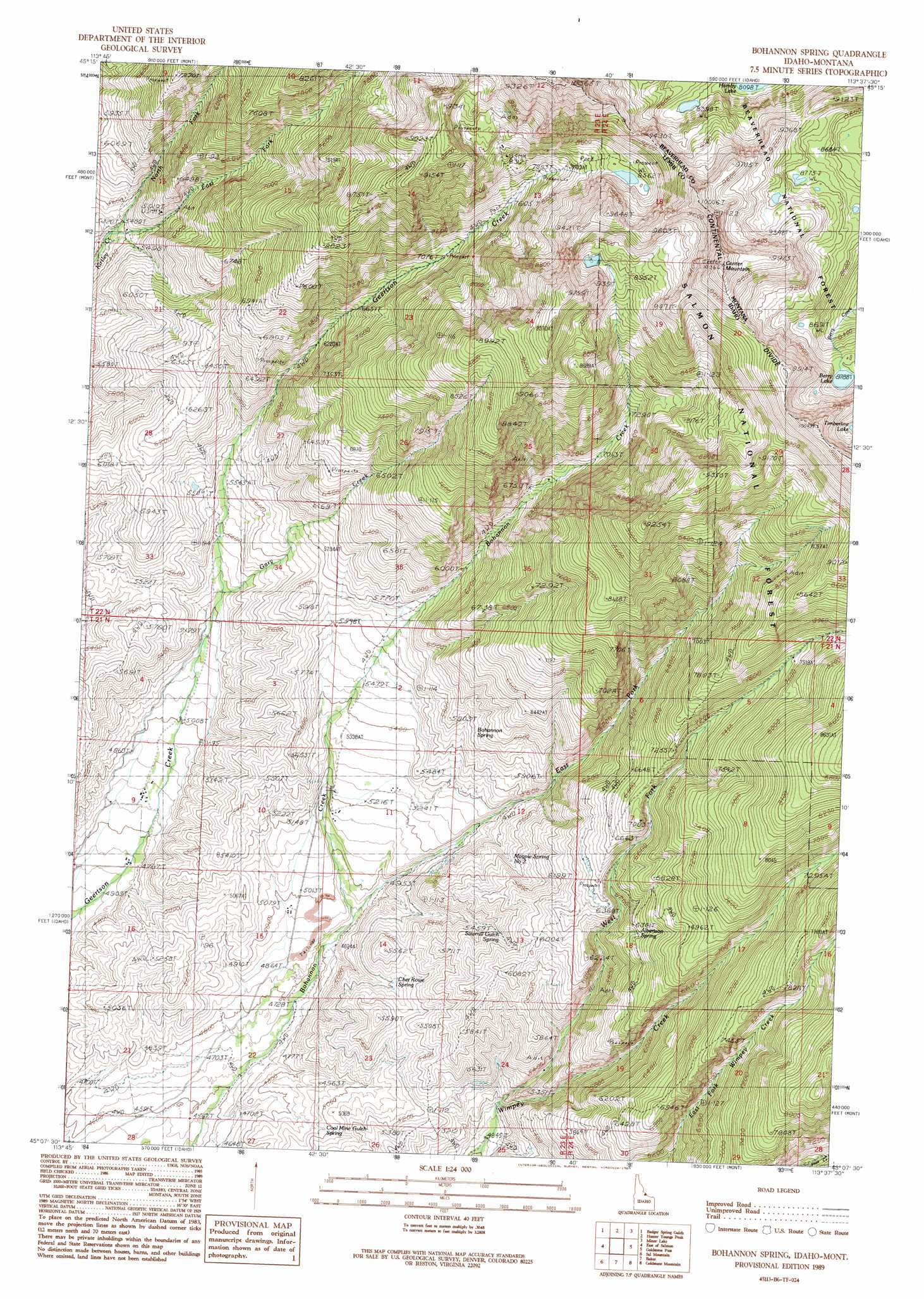
Bohannon Spring Topo Map Idaho
To zoom in, hover over the map of Bohannon Spring
USGS Topo Quad 45113b6 - 1:24,000 scale
| Topo Map Name: | Bohannon Spring |
| USGS Topo Quad ID: | 45113b6 |
| Print Size: | ca. 21 1/4" wide x 27" high |
| Southeast Coordinates: | 45.125° N latitude / 113.625° W longitude |
| Map Center Coordinates: | 45.1875° N latitude / 113.6875° W longitude |
| U.S. States: | ID, MT |
| Filename: | o45113b6.jpg |
| Download Map JPG Image: | Bohannon Spring topo map 1:24,000 scale |
| Map Type: | Topographic |
| Topo Series: | 7.5´ |
| Map Scale: | 1:24,000 |
| Source of Map Images: | United States Geological Survey (USGS) |
| Alternate Map Versions: |
Bohannon Spring ID 1989, updated 1989 Download PDF Buy paper map Bohannon Spring ID 1997, updated 2002 Download PDF Buy paper map Bohannon Spring ID 2011 Download PDF Buy paper map Bohannon Spring ID 2013 Download PDF Buy paper map |
| FStopo: | US Forest Service topo Bohannon Spring is available: Download FStopo PDF Download FStopo TIF |
1:24,000 Topo Quads surrounding Bohannon Spring
North Fork |
Shewag Lake |
Jumbo Mountain |
Ajax Ranch |
Fox Gulch |
Bird Creek |
Badger Spring Gulch |
Homer Youngs Peak |
Miner Lake |
Jackson |
Salmon |
East Of Salmon |
Bohannon Spring |
Goldstone Pass |
Selway Mountain |
Williams Lake |
Sal Mountain |
Baker |
Goldstone Mountain |
Kitty Creek |
Goldbug Ridge |
Poison Peak |
Tendoy |
Agency Creek |
Lemhi Pass |
> Back to 45113a1 at 1:100,000 scale
> Back to 45112a1 at 1:250,000 scale
> Back to U.S. Topo Maps home
Bohannon Spring topo map: Gazetteer
Bohannon Spring: Dams
Bohannon Dam elevation 2682m 8799′Geertson Dam elevation 2684m 8805′
Bohannon Spring: Lakes
Berry Lake elevation 2681m 8795′Bohannon Spring: Springs
Albertson Spring elevation 1938m 6358′Bohannon Spring elevation 1765m 5790′
Chet Rowe Spring elevation 1600m 5249′
Coal Mine Gulch Spring elevation 1508m 4947′
Magpie Spring Number 2 elevation 1729m 5672′
Sawmill Gulch Spring elevation 1698m 5570′
Bohannon Spring: Streams
East Fork Bohannon Creek elevation 1488m 4881′East Fork Kirtley Creek elevation 1652m 5419′
Gary Creek elevation 1603m 5259′
North Fork Kirtley Creek elevation 1639m 5377′
West Fork Wimpey Creek elevation 1506m 4940′
Bohannon Spring: Summits
Center Mountain elevation 3111m 10206′Center Mountain elevation 3113m 10213′
Bohannon Spring digital topo map on disk
Buy this Bohannon Spring topo map showing relief, roads, GPS coordinates and other geographical features, as a high-resolution digital map file on DVD: