East Of Salmon Topo Map Idaho
To zoom in, hover over the map of East Of Salmon
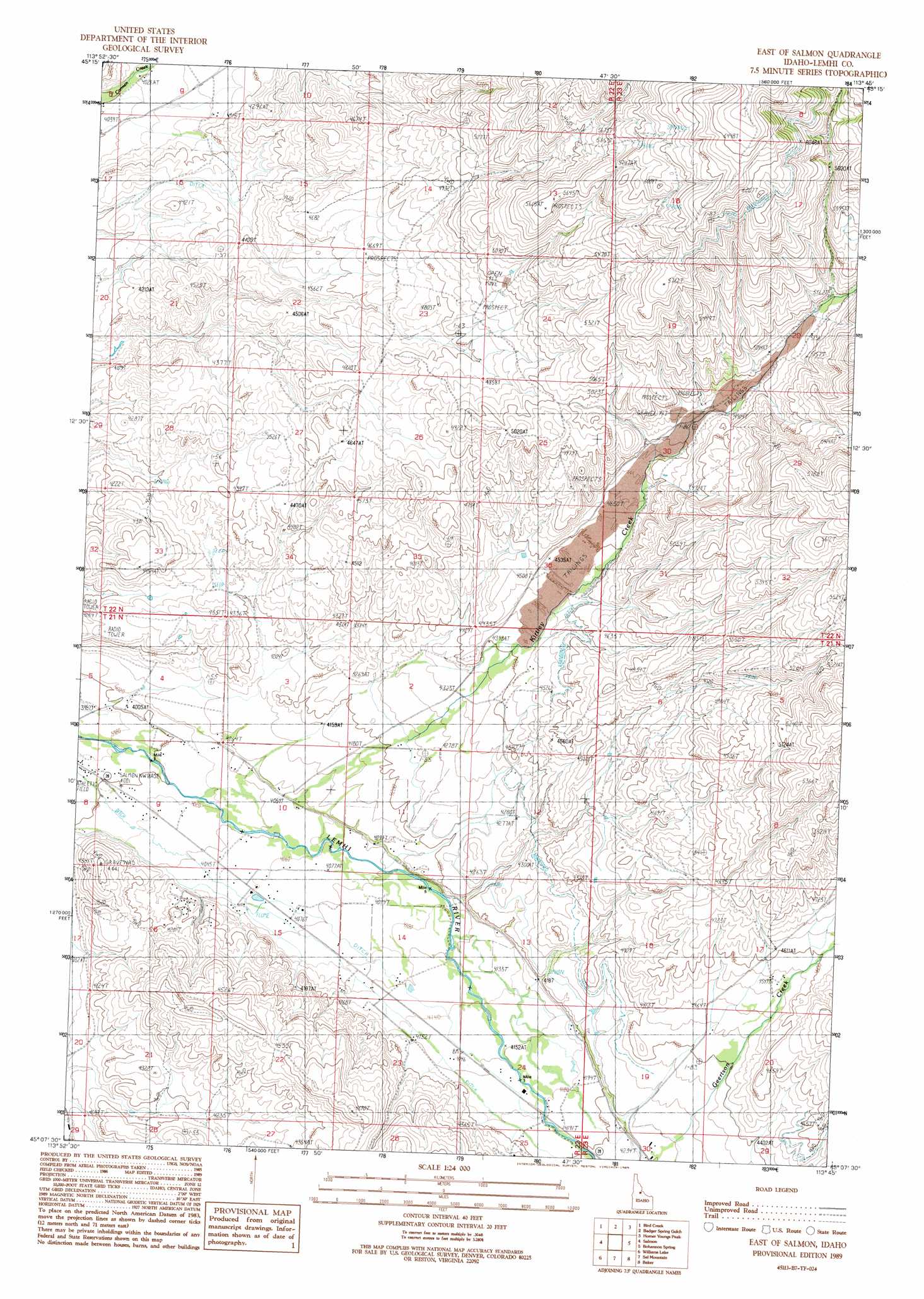
USGS Topo Quad 45113b7 - 1:24,000 scale
| Topo Map Name: | East Of Salmon |
| USGS Topo Quad ID: | 45113b7 |
| Print Size: | ca. 21 1/4" wide x 27" high |
| Southeast Coordinates: | 45.125° N latitude / 113.75° W longitude |
| Map Center Coordinates: | 45.1875° N latitude / 113.8125° W longitude |
| U.S. State: | ID |
| Filename: | o45113b7.jpg |
| Download Map JPG Image: | East Of Salmon topo map 1:24,000 scale |
| Map Type: | Topographic |
| Topo Series: | 7.5´ |
| Map Scale: | 1:24,000 |
| Source of Map Images: | United States Geological Survey (USGS) |
| Alternate Map Versions: |
East of Salmon ID 1989, updated 1989 Download PDF Buy paper map East of Salmon ID 2010 Download PDF Buy paper map East of Salmon ID 2013 Download PDF Buy paper map |
| FStopo: | US Forest Service topo East of Salmon is available: Download FStopo PDF Download FStopo TIF |
1:24,000 Topo Quads surrounding East Of Salmon
Ulysses Mountain |
North Fork |
Shewag Lake |
Jumbo Mountain |
Ajax Ranch |
Napoleon Hill |
Bird Creek |
Badger Spring Gulch |
Homer Youngs Peak |
Miner Lake |
Leesburg |
Salmon |
East Of Salmon |
Bohannon Spring |
Goldstone Pass |
Lake Mountain |
Williams Lake |
Sal Mountain |
Baker |
Goldstone Mountain |
Degan Mountain |
Goldbug Ridge |
Poison Peak |
Tendoy |
Agency Creek |
> Back to 45113a1 at 1:100,000 scale
> Back to 45112a1 at 1:250,000 scale
> Back to U.S. Topo Maps home
East Of Salmon topo map: Gazetteer
East Of Salmon: Dams
Warm Springs Creek Dam elevation 1272m 4173′East Of Salmon: Streams
Geertson Creek elevation 1307m 4288′Kirtley Creek elevation 1222m 4009′
East Of Salmon digital topo map on disk
Buy this East Of Salmon topo map showing relief, roads, GPS coordinates and other geographical features, as a high-resolution digital map file on DVD: