Miner Lake Topo Map Montana
To zoom in, hover over the map of Miner Lake
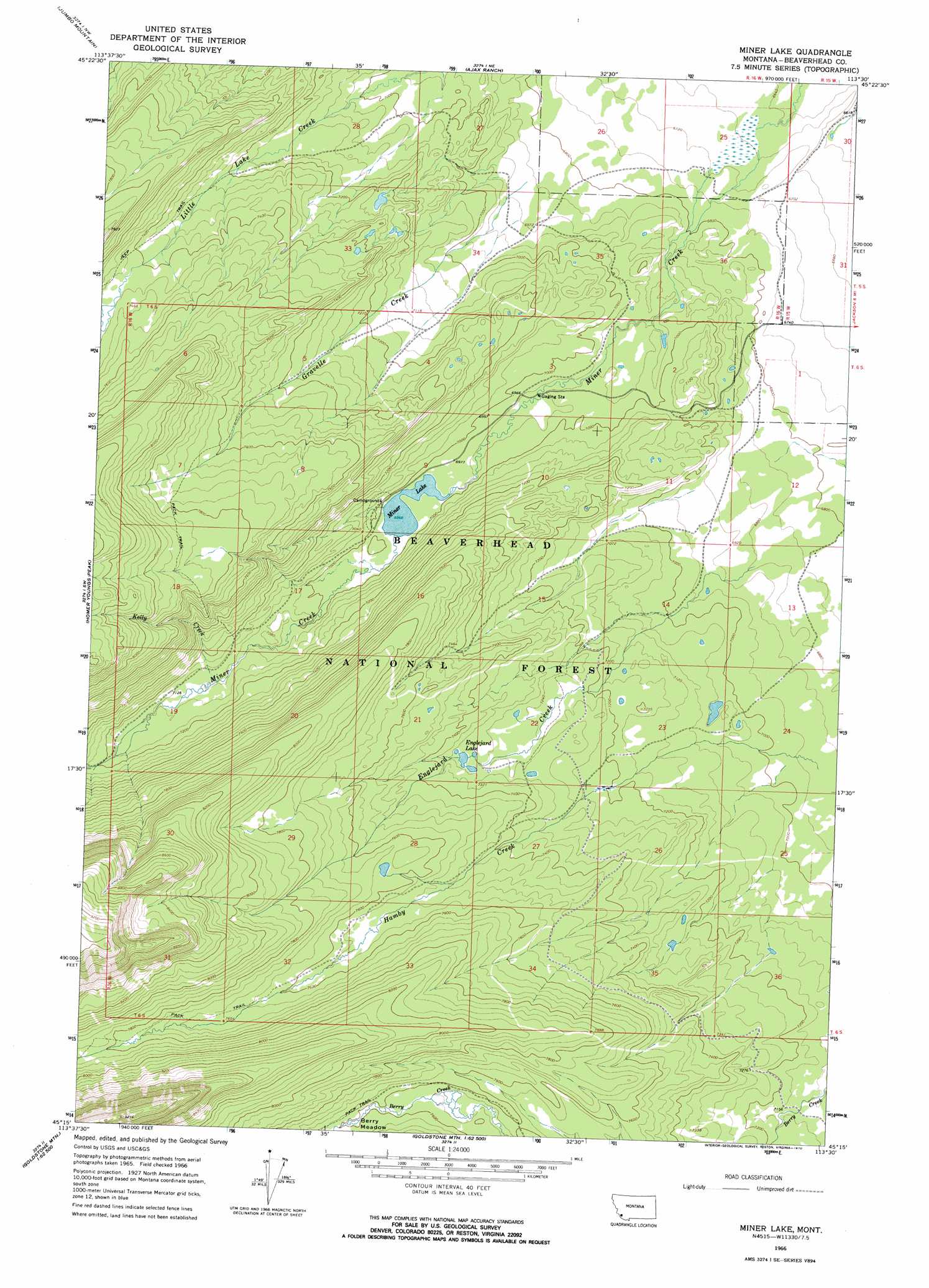
USGS Topo Quad 45113c5 - 1:24,000 scale
| Topo Map Name: | Miner Lake |
| USGS Topo Quad ID: | 45113c5 |
| Print Size: | ca. 21 1/4" wide x 27" high |
| Southeast Coordinates: | 45.25° N latitude / 113.5° W longitude |
| Map Center Coordinates: | 45.3125° N latitude / 113.5625° W longitude |
| U.S. State: | MT |
| Filename: | o45113c5.jpg |
| Download Map JPG Image: | Miner Lake topo map 1:24,000 scale |
| Map Type: | Topographic |
| Topo Series: | 7.5´ |
| Map Scale: | 1:24,000 |
| Source of Map Images: | United States Geological Survey (USGS) |
| Alternate Map Versions: |
Miner Lake MT 1966, updated 1970 Download PDF Buy paper map Miner Lake MT 1966, updated 1970 Download PDF Buy paper map Lower Miner Lakes MT 1997, updated 2001 Download PDF Buy paper map Lower Miner Lakes MT 2011 Download PDF Buy paper map Lower Miner Lakes MT 2014 Download PDF Buy paper map |
| FStopo: | US Forest Service topo Lower Miner Lakes is available: Download FStopo PDF Download FStopo TIF |
1:24,000 Topo Quads surrounding Miner Lake
Big Hole Pass |
Isaac Meadows |
Highland Ranch |
Wisdom |
Stewart Mountain |
Shewag Lake |
Jumbo Mountain |
Ajax Ranch |
Fox Gulch |
Jackson Hill |
Badger Spring Gulch |
Homer Youngs Peak |
Miner Lake |
Jackson |
Butch Hill |
East Of Salmon |
Bohannon Spring |
Goldstone Pass |
Selway Mountain |
Peterson Lake |
Sal Mountain |
Baker |
Goldstone Mountain |
Kitty Creek |
Coyote Creek |
> Back to 45113a1 at 1:100,000 scale
> Back to 45112a1 at 1:250,000 scale
> Back to U.S. Topo Maps home
Miner Lake topo map: Gazetteer
Miner Lake: Flats
Gravelle Park elevation 2149m 7050′Miner Lake: Lakes
Englejard Lake elevation 2231m 7319′Lower Miner Lakes elevation 2126m 6975′
Miner Lake: Parks
Gravelle Park elevation 2155m 7070′Miner Lake: Springs
06S16W09CBDA01 Spring elevation 2139m 7017′Miner Lake: Streams
Gravelle Creek elevation 2092m 6863′Kelly Creek elevation 2159m 7083′
Miner Lake: Wells
06S16W09CBDC01 Well elevation 2135m 7004′06S16W09CBDD01 Well elevation 2135m 7004′
06S16W09CCCD01 Well elevation 2135m 7004′
Miner Lake digital topo map on disk
Buy this Miner Lake topo map showing relief, roads, GPS coordinates and other geographical features, as a high-resolution digital map file on DVD: