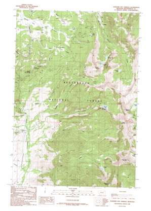
Elkhorn Hot Springs Topo Map Montana
To zoom in, hover over the map of Elkhorn Hot Springs
USGS Topo Quad 45113d1 - 1:24,000 scale
| Topo Map Name: | Elkhorn Hot Springs |
| USGS Topo Quad ID: | 45113d1 |
| Print Size: | ca. 21 1/4" wide x 27" high |
| Southeast Coordinates: | 45.375° N latitude / 113° W longitude |
| Map Center Coordinates: | 45.4375° N latitude / 113.0625° W longitude |
| U.S. State: | MT |
| Filename: | o45113d1.jpg |
| Download Map JPG Image: | Elkhorn Hot Springs topo map 1:24,000 scale |
| Map Type: | Topographic |
| Topo Series: | 7.5´ |
| Map Scale: | 1:24,000 |
| Source of Map Images: | United States Geological Survey (USGS) |
| Alternate Map Versions: |
Elkhorn Hot Springs MT 1988, updated 1989 Download PDF Buy paper map Elkhorn Hot Springs MT 1997, updated 2002 Download PDF Buy paper map Elkhorn Hot Springs MT 2005, updated 2005 Download PDF Buy paper map Elkhorn Hot Springs MT 2011 Download PDF Buy paper map Elkhorn Hot Springs MT 2014 Download PDF Buy paper map |
| FStopo: | US Forest Service topo Elkhorn Hot Springs is available: Download FStopo PDF Download FStopo TIF |
1:24,000 Topo Quads surrounding Elkhorn Hot Springs
> Back to 45113a1 at 1:100,000 scale
> Back to 45112a1 at 1:250,000 scale
> Back to U.S. Topo Maps home
Elkhorn Hot Springs topo map: Gazetteer
Elkhorn Hot Springs: Flats
Crystal Park elevation 2345m 7693′Elkhorn Park elevation 2319m 7608′
Harrison Park elevation 2321m 7614′
Sheldon Park elevation 2379m 7805′
Elkhorn Hot Springs: Lakes
Anchor Lake elevation 2787m 9143′Chain Lake elevation 2958m 9704′
Chan Lake elevation 2752m 9028′
Dingley Lakes elevation 2713m 8900′
Dollar Lake elevation 2799m 9183′
Elkhorn Lake elevation 2652m 8700′
Hall Lake elevation 2705m 8874′
Hopkin Lake elevation 2709m 8887′
Polaris Lake elevation 2498m 8195′
Sawtooth Lake elevation 2596m 8517′
Elkhorn Hot Springs: Mines
Aspen Mine elevation 2523m 8277′Blue Eyed Annie Mine elevation 2479m 8133′
Boatman Lake Mine elevation 2621m 8599′
Copper Queen Mine elevation 2479m 8133′
Elkhorn Mill Mine elevation 2265m 7431′
Gar Mine elevation 2865m 9399′
Gar Mine elevation 2881m 9452′
Guy Mine elevation 2468m 8097′
Lost Cloud Mine elevation 2535m 8316′
Magna Mine elevation 2597m 8520′
Magna Mine elevation 2630m 8628′
Old Elkhorn Mine elevation 2299m 7542′
Old Elkhorn Mine elevation 2299m 7542′
Park Mine elevation 2604m 8543′
Park Mine elevation 2603m 8540′
Upper Elkhorn Mine elevation 2484m 8149′
Wellman Mine elevation 2247m 7372′
Elkhorn Hot Springs: Parks
Dutch Park elevation 2440m 8005′Goodenough Park elevation 2379m 7805′
Elkhorn Hot Springs: Populated Places
Coolidge (historical) elevation 2277m 7470′Elkhorn elevation 2277m 7470′
Elkhorn Hot Springs elevation 2169m 7116′
Elkhorn Hot Springs: Post Offices
Aurora Post Office (historical) elevation 2169m 7116′Coolidge Post Office (historical) elevation 2277m 7470′
Elkhorn Hot Springs: Springs
04S12W29ACC_01 Spring elevation 2213m 7260′Elkhorn Hot Springs elevation 2191m 7188′
Elkhorn Hot Springs: Streams
Blue Creek elevation 2091m 6860′Clark Creek elevation 1980m 6496′
Dingley Creek elevation 1990m 6528′
Dory Creek elevation 2001m 6564′
Hot Springs Creek elevation 2105m 6906′
Lake Creek elevation 1951m 6400′
Price Creek elevation 2305m 7562′
Shale Creek elevation 1985m 6512′
Shoestring Creek elevation 2226m 7303′
Snyder Creek elevation 1951m 6400′
Wellman Creek elevation 2004m 6574′
White Creek elevation 1971m 6466′
Elkhorn Hot Springs: Summits
Alturas Number One Mountain elevation 3067m 10062′Alturas Number Two Mountain elevation 3191m 10469′
Comet Mountain elevation 3114m 10216′
Goat Mountain elevation 2754m 9035′
Highboy Mountain elevation 3174m 10413′
Saddleback Mountain elevation 3062m 10045′
Sawtooth Mountain elevation 3054m 10019′
Elkhorn Hot Springs: Trails
Driveway Trail elevation 2294m 7526′Rhubarb Patch Trail elevation 2184m 7165′
Elkhorn Hot Springs: Valleys
Saint Louis Gulch elevation 2326m 7631′Elkhorn Hot Springs: Wells
04S12W29CCCA01 Well elevation 2112m 6929′05S12W08AADC01 Well elevation 2011m 6597′
05S12W08CBAA01 Well elevation 2011m 6597′
05S12W17CBBA01 Well elevation 2034m 6673′
Elkhorn Hot Springs digital topo map on disk
Buy this Elkhorn Hot Springs topo map showing relief, roads, GPS coordinates and other geographical features, as a high-resolution digital map file on DVD:


