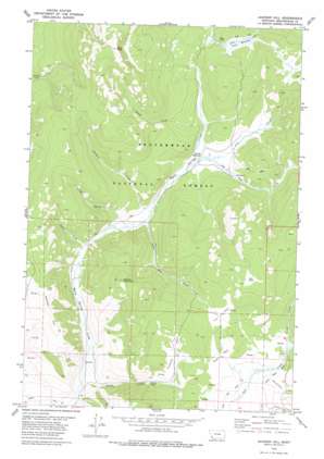
Jackson Hill Topo Map Montana
To zoom in, hover over the map of Jackson Hill
USGS Topo Quad 45113d3 - 1:24,000 scale
| Topo Map Name: | Jackson Hill |
| USGS Topo Quad ID: | 45113d3 |
| Print Size: | ca. 21 1/4" wide x 27" high |
| Southeast Coordinates: | 45.375° N latitude / 113.25° W longitude |
| Map Center Coordinates: | 45.4375° N latitude / 113.3125° W longitude |
| U.S. State: | MT |
| Filename: | o45113d3.jpg |
| Download Map JPG Image: | Jackson Hill topo map 1:24,000 scale |
| Map Type: | Topographic |
| Topo Series: | 7.5´ |
| Map Scale: | 1:24,000 |
| Source of Map Images: | United States Geological Survey (USGS) |
| Alternate Map Versions: |
Jackson Hill MT 1978, updated 1979 Download PDF Buy paper map Jackson Hill MT 1997, updated 2002 Download PDF Buy paper map Jackson Hill MT 2011 Download PDF Buy paper map Jackson Hill MT 2014 Download PDF Buy paper map |
| FStopo: | US Forest Service topo Jackson Hill is available: Download FStopo PDF Download FStopo TIF |
1:24,000 Topo Quads surrounding Jackson Hill
> Back to 45113a1 at 1:100,000 scale
> Back to 45112a1 at 1:250,000 scale
> Back to U.S. Topo Maps home
Jackson Hill topo map: Gazetteer
Jackson Hill: Canals
Gloss Upper Ditch elevation 2207m 7240′Jardine Ditch elevation 2021m 6630′
West Side Ditch elevation 2154m 7066′
Jackson Hill: Flats
Cox Park elevation 2323m 7621′Open Park elevation 2243m 7358′
Richards Park elevation 2225m 7299′
Star Park elevation 2458m 8064′
Jackson Hill: Lakes
Steer Lake elevation 2262m 7421′Jackson Hill: Mines
Carney Mine elevation 2165m 7103′Carney Mine elevation 2157m 7076′
Jackson Hill: Streams
Bear Creek elevation 2254m 7395′Cox Creek elevation 2147m 7043′
East Fork Bull Creek elevation 2218m 7276′
Heath Creek elevation 2169m 7116′
Hunter Creek elevation 2218m 7276′
Jackson Creek elevation 2117m 6945′
Kunselman Creek elevation 2202m 7224′
Little Milk Creek elevation 2115m 6938′
Old Tim Creek elevation 2146m 7040′
Poison Creek elevation 2082m 6830′
Woody Creek elevation 2033m 6669′
Jackson Hill: Summits
Butch Hill elevation 2395m 7857′Deer Peak elevation 2795m 9169′
Jackson Hill elevation 2443m 8015′
Woody Mountain elevation 2480m 8136′
Jackson Hill: Swamps
Steer Meadow elevation 2262m 7421′Jackson Hill: Valleys
Knight Gulch elevation 2123m 6965′Jackson Hill digital topo map on disk
Buy this Jackson Hill topo map showing relief, roads, GPS coordinates and other geographical features, as a high-resolution digital map file on DVD:


