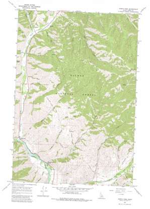
North Fork Topo Map Idaho
To zoom in, hover over the map of North Fork
USGS Topo Quad 45113d8 - 1:24,000 scale
| Topo Map Name: | North Fork |
| USGS Topo Quad ID: | 45113d8 |
| Print Size: | ca. 21 1/4" wide x 27" high |
| Southeast Coordinates: | 45.375° N latitude / 113.875° W longitude |
| Map Center Coordinates: | 45.4375° N latitude / 113.9375° W longitude |
| U.S. State: | ID |
| Filename: | o45113d8.jpg |
| Download Map JPG Image: | North Fork topo map 1:24,000 scale |
| Map Type: | Topographic |
| Topo Series: | 7.5´ |
| Map Scale: | 1:24,000 |
| Source of Map Images: | United States Geological Survey (USGS) |
| Alternate Map Versions: |
North Fork ID 1966, updated 1971 Download PDF Buy paper map North Fork ID 1966, updated 1981 Download PDF Buy paper map North Fork ID 2011 Download PDF Buy paper map North Fork ID 2013 Download PDF Buy paper map |
| FStopo: | US Forest Service topo North Fork is available: Download FStopo PDF Download FStopo TIF |
1:24,000 Topo Quads surrounding North Fork
> Back to 45113a1 at 1:100,000 scale
> Back to 45112a1 at 1:250,000 scale
> Back to U.S. Topo Maps home
North Fork topo map: Gazetteer
North Fork: Airports
Cumming Triangle Landing Area elevation 1201m 3940′North Fork: Parks
Lewis and Clark Monument elevation 1195m 3920′North Fork: Populated Places
North Fork elevation 1107m 3631′North Fork: Springs
Wagonhammer Spring elevation 1121m 3677′North Fork: Streams
Big Silverlead Creek elevation 1108m 3635′Cottonwood Creek elevation 1377m 4517′
Dry Creek elevation 1138m 3733′
Hughes Creek elevation 1202m 3943′
Hull Creek elevation 1191m 3907′
Little Fourth of July Creek elevation 1224m 4015′
Little Hull Creek elevation 1221m 4005′
Little Silverlead Creek elevation 1249m 4097′
North Fork Salmon River elevation 1105m 3625′
Sheep Creek elevation 1390m 4560′
Wagonhammer Creek elevation 1273m 4176′
North Fork: Summits
Stein Mountain elevation 2601m 8533′North Fork: Valleys
Bills Canyon elevation 1205m 3953′Burns Gulch elevation 1119m 3671′
Carl Gulch elevation 1245m 4084′
Copper Gulch elevation 1176m 3858′
Dry Gulch elevation 1125m 3690′
Dry Gulch elevation 1148m 3766′
Dry Gulch elevation 1257m 4124′
Grouse Gulch elevation 1260m 4133′
Little Thompson Gulch elevation 1275m 4183′
Magpie Canyon elevation 1344m 4409′
Maxwell Gulch elevation 1123m 3684′
Rathburn Gulch elevation 1194m 3917′
Roske Gulch elevation 1194m 3917′
Stein Gulch elevation 1257m 4124′
Trail Gulch elevation 1183m 3881′
North Fork digital topo map on disk
Buy this North Fork topo map showing relief, roads, GPS coordinates and other geographical features, as a high-resolution digital map file on DVD:


