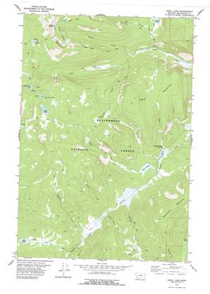
Odell Lake Topo Map Montana
To zoom in, hover over the map of Odell Lake
USGS Topo Quad 45113e2 - 1:24,000 scale
| Topo Map Name: | Odell Lake |
| USGS Topo Quad ID: | 45113e2 |
| Print Size: | ca. 21 1/4" wide x 27" high |
| Southeast Coordinates: | 45.5° N latitude / 113.125° W longitude |
| Map Center Coordinates: | 45.5625° N latitude / 113.1875° W longitude |
| U.S. State: | MT |
| Filename: | o45113e2.jpg |
| Download Map JPG Image: | Odell Lake topo map 1:24,000 scale |
| Map Type: | Topographic |
| Topo Series: | 7.5´ |
| Map Scale: | 1:24,000 |
| Source of Map Images: | United States Geological Survey (USGS) |
| Alternate Map Versions: |
Odell Lake MT 1978, updated 1978 Download PDF Buy paper map Odell Lake MT 1997, updated 2002 Download PDF Buy paper map Odell Lake MT 2011 Download PDF Buy paper map Odell Lake MT 2014 Download PDF Buy paper map |
| FStopo: | US Forest Service topo Odell Lake is available: Download FStopo PDF Download FStopo TIF |
1:24,000 Topo Quads surrounding Odell Lake
> Back to 45113e1 at 1:100,000 scale
> Back to 45112a1 at 1:250,000 scale
> Back to U.S. Topo Maps home
Odell Lake topo map: Gazetteer
Odell Lake: Lakes
Bear Lake elevation 2314m 7591′Bobcat Lakes elevation 2569m 8428′
Grassy Lake elevation 2520m 8267′
Lake of the Woods elevation 2576m 8451′
Odell Lake elevation 2534m 8313′
Schwinegar Lake elevation 2507m 8225′
Odell Lake: Mines
Bearpaw Mine elevation 2544m 8346′Odell Lake: Streams
Armor Creek elevation 2212m 7257′Bobcat Creek elevation 2102m 6896′
Deer Creek elevation 2239m 7345′
Giant Powder Creek elevation 2213m 7260′
Halfway Creek elevation 2212m 7257′
Lambrecht Creek elevation 2202m 7224′
Odell Creek elevation 2185m 7168′
Rabbia Creek elevation 2212m 7257′
Skull Creek elevation 2125m 6971′
Stringer Creek elevation 2182m 7158′
Table Creek elevation 2174m 7132′
Odell Lake: Summits
Bobcat Mountain elevation 2784m 9133′Seymore Mountain elevation 2711m 8894′
Table Mountain elevation 2566m 8418′
Odell Lake: Swamps
Lower Anderson Meadows elevation 2179m 7148′Odell Meadows elevation 2203m 7227′
Skull Creek Meadows elevation 2434m 7985′
Upper Anderson Meadows elevation 2213m 7260′
Odell Lake: Trails
Bobcat Lakes Trail elevation 2518m 8261′Grassy Lake Trail elevation 2657m 8717′
Odell Lake digital topo map on disk
Buy this Odell Lake topo map showing relief, roads, GPS coordinates and other geographical features, as a high-resolution digital map file on DVD:


