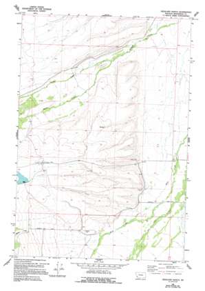
Highland Ranch Topo Map Montana
To zoom in, hover over the map of Highland Ranch
USGS Topo Quad 45113e5 - 1:24,000 scale
| Topo Map Name: | Highland Ranch |
| USGS Topo Quad ID: | 45113e5 |
| Print Size: | ca. 21 1/4" wide x 27" high |
| Southeast Coordinates: | 45.5° N latitude / 113.5° W longitude |
| Map Center Coordinates: | 45.5625° N latitude / 113.5625° W longitude |
| U.S. State: | MT |
| Filename: | o45113e5.jpg |
| Download Map JPG Image: | Highland Ranch topo map 1:24,000 scale |
| Map Type: | Topographic |
| Topo Series: | 7.5´ |
| Map Scale: | 1:24,000 |
| Source of Map Images: | United States Geological Survey (USGS) |
| Alternate Map Versions: |
Highland Ranch MT 1966, updated 1970 Download PDF Buy paper map Highland Ranch MT 1966, updated 1994 Download PDF Buy paper map Highland Ranch MT 1997, updated 2002 Download PDF Buy paper map Highland Ranch MT 2011 Download PDF Buy paper map Highland Ranch MT 2014 Download PDF Buy paper map |
| FStopo: | US Forest Service topo Highland Ranch is available: Download FStopo PDF Download FStopo TIF |
1:24,000 Topo Quads surrounding Highland Ranch
> Back to 45113e1 at 1:100,000 scale
> Back to 45112a1 at 1:250,000 scale
> Back to U.S. Topo Maps home
Highland Ranch topo map: Gazetteer
Highland Ranch: Dams
Hirschy Dam elevation 1996m 6548′Highland Ranch: Mines
Alps Mine elevation 1888m 6194′Highland Ranch: Post Offices
Briston Post Office (historical) elevation 1935m 6348′Highland Ranch: Reservoirs
Hirschy Reservoir elevation 1996m 6548′Highland Ranch: Streams
Mifflin Creek elevation 1988m 6522′Moose Creek elevation 1873m 6145′
Highland Ranch: Wells
03S16W09ABBC01 Well elevation 1891m 6204′03S16W31DDAD01 Well elevation 1985m 6512′
03S16W31DDDD01 Well elevation 1987m 6519′
03S16W36ACDA01 Well elevation 1883m 6177′
03S16W36ACDD01 Well elevation 1884m 6181′
04S16W03CBBB01 Well elevation 1940m 6364′
04S16W06DAAA01 Well elevation 1989m 6525′
04S16W06DAAD01 Well elevation 1991m 6532′
Highland Ranch digital topo map on disk
Buy this Highland Ranch topo map showing relief, roads, GPS coordinates and other geographical features, as a high-resolution digital map file on DVD:


