Bender Point Topo Map Montana
To zoom in, hover over the map of Bender Point
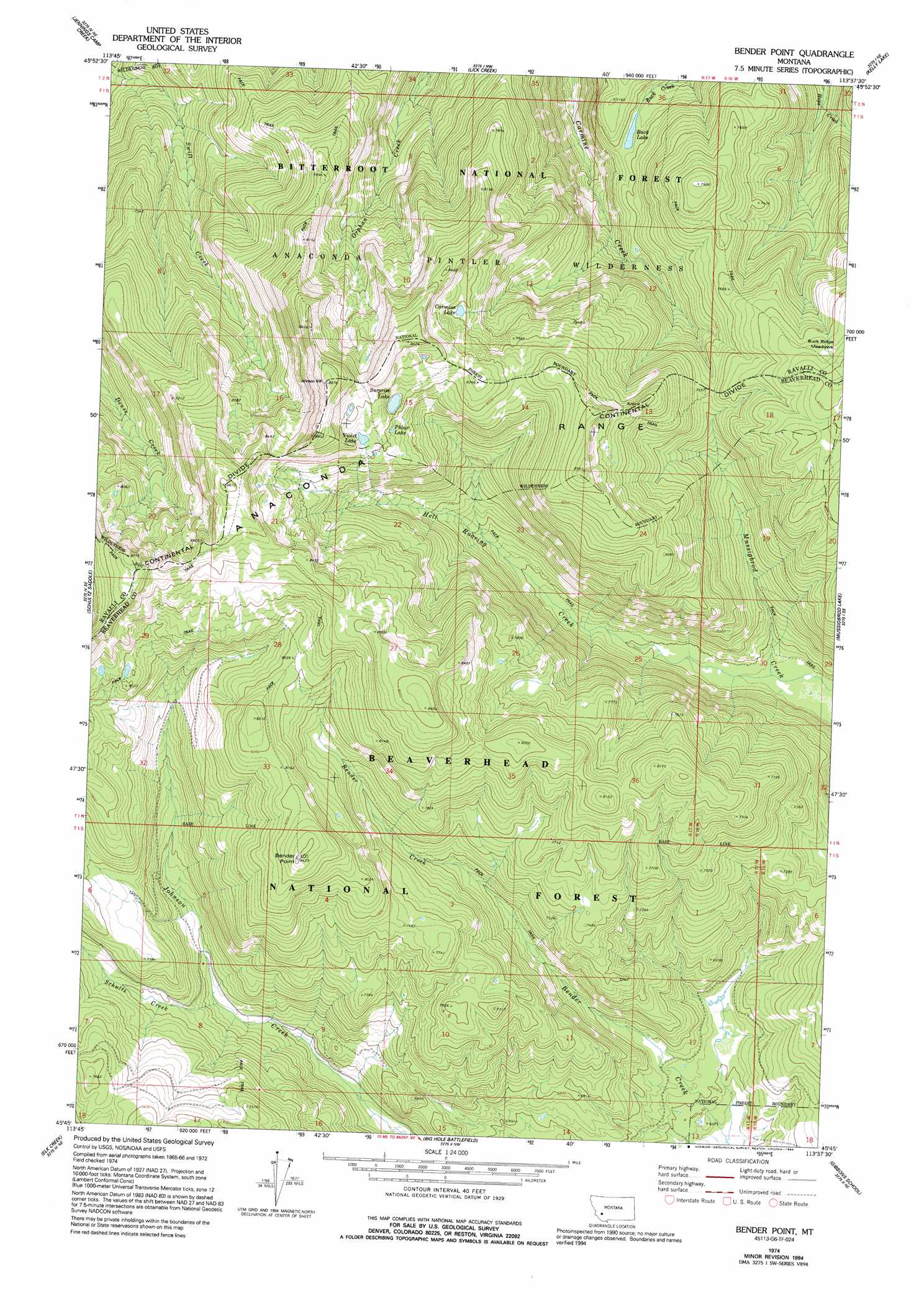
USGS Topo Quad 45113g6 - 1:24,000 scale
| Topo Map Name: | Bender Point |
| USGS Topo Quad ID: | 45113g6 |
| Print Size: | ca. 21 1/4" wide x 27" high |
| Southeast Coordinates: | 45.75° N latitude / 113.625° W longitude |
| Map Center Coordinates: | 45.8125° N latitude / 113.6875° W longitude |
| U.S. State: | MT |
| Filename: | o45113g6.jpg |
| Download Map JPG Image: | Bender Point topo map 1:24,000 scale |
| Map Type: | Topographic |
| Topo Series: | 7.5´ |
| Map Scale: | 1:24,000 |
| Source of Map Images: | United States Geological Survey (USGS) |
| Alternate Map Versions: |
Bender Point MT 1974, updated 1977 Download PDF Buy paper map Bender Point MT 1974, updated 1994 Download PDF Buy paper map Bender Point MT 1997, updated 2002 Download PDF Buy paper map Bender Point MT 2011 Download PDF Buy paper map Bender Point MT 2014 Download PDF Buy paper map |
| FStopo: | US Forest Service topo Bender Point is available: Download FStopo PDF Download FStopo TIF |
1:24,000 Topo Quads surrounding Bender Point
Bald Top Mountain |
Kent Peak |
Whetstone Ridge |
Moose Lake |
Carpp Ridge |
French Basin |
Jennings Camp Creek |
Lick Creek |
Kelly Lake |
Warren Peak |
Sula |
Schultz Saddle |
Bender Point |
Mussigbrod Lake |
Pintlar Lake |
Lost Trail Pass |
Elk Creek |
Big Hole Battlefield |
Gibbons School |
Mud Lake |
Gibbonsville |
Big Hole Pass |
Isaac Meadows |
Highland Ranch |
Wisdom |
> Back to 45113e1 at 1:100,000 scale
> Back to 45112a1 at 1:250,000 scale
> Back to U.S. Topo Maps home
Bender Point topo map: Gazetteer
Bender Point: Flats
Buck Ridge Meadows elevation 2402m 7880′Bender Point: Lakes
Buck Lake elevation 2117m 6945′Carmine Lake elevation 2436m 7992′
Phlox Lake elevation 2491m 8172′
Surprise Lake elevation 2497m 8192′
Violet Lake elevation 2522m 8274′
Bender Point: Streams
Hell Roaring Creek elevation 1984m 6509′Schultz Creek elevation 2049m 6722′
Bender Point: Summits
Bender Point elevation 2564m 8412′Bender Point digital topo map on disk
Buy this Bender Point topo map showing relief, roads, GPS coordinates and other geographical features, as a high-resolution digital map file on DVD: