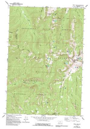
Kelly Lake Topo Map Montana
To zoom in, hover over the map of Kelly Lake
USGS Topo Quad 45113h5 - 1:24,000 scale
| Topo Map Name: | Kelly Lake |
| USGS Topo Quad ID: | 45113h5 |
| Print Size: | ca. 21 1/4" wide x 27" high |
| Southeast Coordinates: | 45.875° N latitude / 113.5° W longitude |
| Map Center Coordinates: | 45.9375° N latitude / 113.5625° W longitude |
| U.S. State: | MT |
| Filename: | o45113h5.jpg |
| Download Map JPG Image: | Kelly Lake topo map 1:24,000 scale |
| Map Type: | Topographic |
| Topo Series: | 7.5´ |
| Map Scale: | 1:24,000 |
| Source of Map Images: | United States Geological Survey (USGS) |
| Alternate Map Versions: |
Kelly Lake MT 1977, updated 1977 Download PDF Buy paper map Kelly Lake MT 1977, updated 1994 Download PDF Buy paper map Kelly Lake MT 1977, updated 1994 Download PDF Buy paper map Kelly Lake MT 2011 Download PDF Buy paper map Kelly Lake MT 2014 Download PDF Buy paper map |
| FStopo: | US Forest Service topo Kelly Lake is available: Download FStopo PDF Download FStopo TIF |
1:24,000 Topo Quads surrounding Kelly Lake
> Back to 45113e1 at 1:100,000 scale
> Back to 45112a1 at 1:250,000 scale
> Back to U.S. Topo Maps home
Kelly Lake topo map: Gazetteer
Kelly Lake: Falls
Star Falls elevation 1870m 6135′Kelly Lake: Flats
Elk Park elevation 2601m 8533′Kelly Lake: Gaps
Bitterroot Pass elevation 2564m 8412′Kelly Lake: Lakes
Alpine Lakes elevation 2423m 7949′Hidden Lake elevation 2507m 8225′
Ivanhoe Lake elevation 2372m 7782′
Kelly Lake elevation 2446m 8024′
Little Johnson Lake elevation 2449m 8034′
Oreamnos Lake elevation 2550m 8366′
Park Lake elevation 2364m 7755′
Phyllis Lake elevation 2421m 7942′
Ripple Lake elevation 2387m 7831′
Sawed Cabin Lake elevation 2570m 8431′
Upper Phyllis Lake elevation 2483m 8146′
Kelly Lake: Mines
Senate Mine elevation 2342m 7683′Senate Mine elevation 2370m 7775′
Kelly Lake: Streams
Alpine Creek elevation 1974m 6476′Park Creek elevation 1979m 6492′
Star Creek elevation 1814m 5951′
Kelly Lake: Summits
Cliff Point elevation 2540m 8333′East Pintler Peak elevation 2878m 9442′
Pintler Peak elevation 2889m 9478′
Senate Mountain elevation 2651m 8697′
West Pintler Peak elevation 2889m 9478′
Kelly Lake: Trails
Hi Line Trail elevation 2616m 8582′Kelly Lake digital topo map on disk
Buy this Kelly Lake topo map showing relief, roads, GPS coordinates and other geographical features, as a high-resolution digital map file on DVD:


