Lake Mountain Topo Map Idaho
To zoom in, hover over the map of Lake Mountain
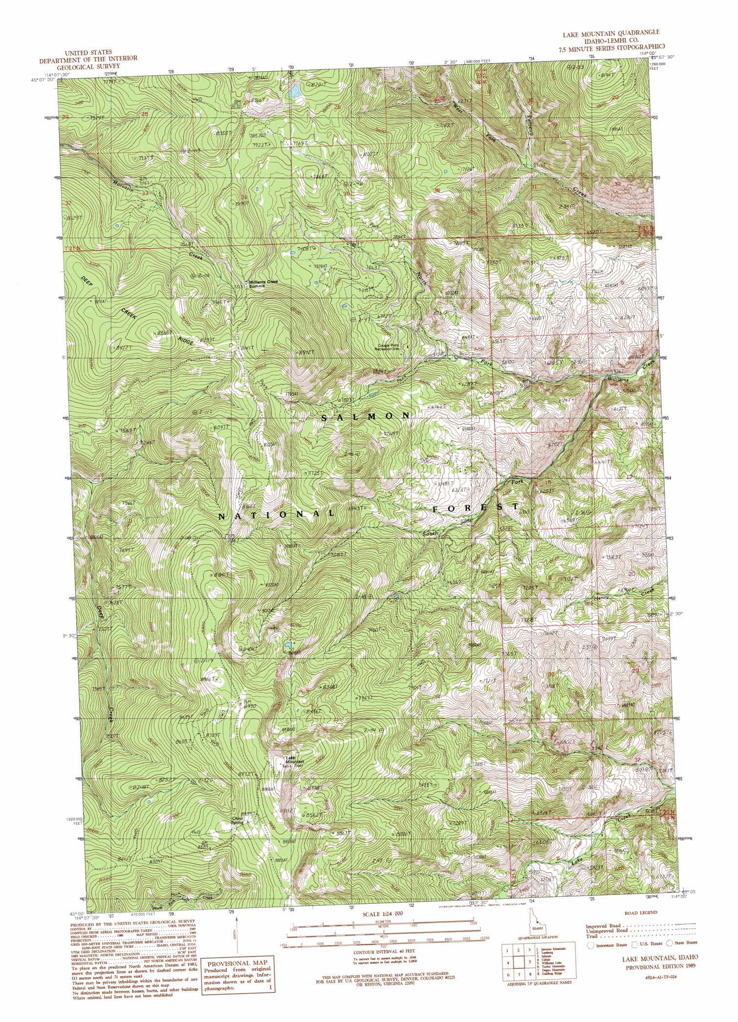
USGS Topo Quad 45114a1 - 1:24,000 scale
| Topo Map Name: | Lake Mountain |
| USGS Topo Quad ID: | 45114a1 |
| Print Size: | ca. 21 1/4" wide x 27" high |
| Southeast Coordinates: | 45° N latitude / 114° W longitude |
| Map Center Coordinates: | 45.0625° N latitude / 114.0625° W longitude |
| U.S. State: | ID |
| Filename: | o45114a1.jpg |
| Download Map JPG Image: | Lake Mountain topo map 1:24,000 scale |
| Map Type: | Topographic |
| Topo Series: | 7.5´ |
| Map Scale: | 1:24,000 |
| Source of Map Images: | United States Geological Survey (USGS) |
| Alternate Map Versions: |
Lake Mountain ID 1989, updated 1989 Download PDF Buy paper map Lake Mountain ID 2011 Download PDF Buy paper map Lake Mountain ID 2013 Download PDF Buy paper map |
| FStopo: | US Forest Service topo Lake Mountain is available: Download FStopo PDF Download FStopo TIF |
1:24,000 Topo Quads surrounding Lake Mountain
Pine Creek Rapids |
Pine Creek Ridge |
Napoleon Hill |
Bird Creek |
Badger Spring Gulch |
Gant Mountain |
Jureano Mountain |
Leesburg |
Salmon |
East Of Salmon |
Blackbird Creek |
Cobalt |
Lake Mountain |
Williams Lake |
Sal Mountain |
Opal Lake |
Taylor Mountain |
Degan Mountain |
Goldbug Ridge |
Poison Peak |
Black Mountain |
Wards Butte |
Hat Creek |
Allison Creek |
Lem Peak |
> Back to 45114a1 at 1:100,000 scale
> Back to 45114a1 at 1:250,000 scale
> Back to U.S. Topo Maps home
Lake Mountain topo map: Gazetteer
Lake Mountain: Gaps
Williams Creek Summit elevation 2384m 7821′Lake Mountain: Ridges
Deep Creek Ridge elevation 2612m 8569′Lake Mountain: Springs
China Spring elevation 2693m 8835′Lake Mountain: Streams
North Fork Williams Creek elevation 1630m 5347′South Fork Williams Creek elevation 1630m 5347′
West Fork Perreau Creek elevation 1741m 5711′
Lake Mountain: Summits
Lake Mountain elevation 2817m 9242′Lake Mountain digital topo map on disk
Buy this Lake Mountain topo map showing relief, roads, GPS coordinates and other geographical features, as a high-resolution digital map file on DVD: