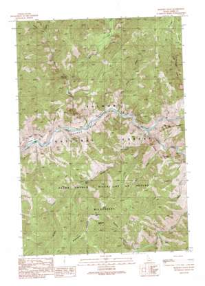
Bighorn Crags Topo Map Idaho
To zoom in, hover over the map of Bighorn Crags
USGS Topo Quad 45114c4 - 1:24,000 scale
| Topo Map Name: | Bighorn Crags |
| USGS Topo Quad ID: | 45114c4 |
| Print Size: | ca. 21 1/4" wide x 27" high |
| Southeast Coordinates: | 45.25° N latitude / 114.375° W longitude |
| Map Center Coordinates: | 45.3125° N latitude / 114.4375° W longitude |
| U.S. State: | ID |
| Filename: | o45114c4.jpg |
| Download Map JPG Image: | Bighorn Crags topo map 1:24,000 scale |
| Map Type: | Topographic |
| Topo Series: | 7.5´ |
| Map Scale: | 1:24,000 |
| Source of Map Images: | United States Geological Survey (USGS) |
| Alternate Map Versions: |
Bighorn Crags ID 1991, updated 1991 Download PDF Buy paper map Bighorn Crags ID 2011 Download PDF Buy paper map Bighorn Crags ID 2013 Download PDF Buy paper map |
| FStopo: | US Forest Service topo Bighorn Crags is available: Download FStopo PDF Download FStopo TIF |
1:24,000 Topo Quads surrounding Bighorn Crags
> Back to 45114a1 at 1:100,000 scale
> Back to 45114a1 at 1:250,000 scale
> Back to U.S. Topo Maps home
Bighorn Crags topo map: Gazetteer
Bighorn Crags: Bridges
Cove Creek Bridge elevation 969m 3179′Bighorn Crags: Flats
Corral Flat elevation 1508m 4947′Poverty Flat elevation 967m 3172′
Bighorn Crags: Springs
Owl Creek Hot Springs elevation 1131m 3710′Sagebrush Spring elevation 2041m 6696′
Bighorn Crags: Streams
Cougar Creek elevation 1259m 4130′Cove Creek elevation 974m 3195′
East Fork Owl Creek elevation 1118m 3667′
Garden Creek elevation 976m 3202′
Owl Creek elevation 962m 3156′
Panther Creek elevation 968m 3175′
Rancherio Creek elevation 1327m 4353′
Swamp Creek elevation 1326m 4350′
Bighorn Crags: Summits
Sagebrush Mountain elevation 2177m 7142′Bighorn Crags: Trails
Pretty Gulch Trail (historical) elevation 1399m 4589′Sagebrush Lookout Trail elevation 1448m 4750′
Bighorn Crags: Valleys
Bear Gulch elevation 1035m 3395′Line Gulch elevation 1108m 3635′
Pretty Gulch elevation 1020m 3346′
Skull Gulch elevation 976m 3202′
Squaw Gulch elevation 1121m 3677′
Bighorn Crags digital topo map on disk
Buy this Bighorn Crags topo map showing relief, roads, GPS coordinates and other geographical features, as a high-resolution digital map file on DVD:


