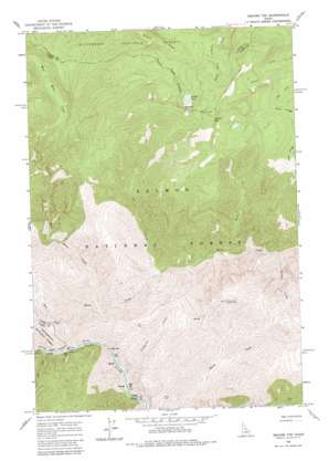
Square Top Topo Map Idaho
To zoom in, hover over the map of Square Top
USGS Topo Quad 45114d6 - 1:24,000 scale
| Topo Map Name: | Square Top |
| USGS Topo Quad ID: | 45114d6 |
| Print Size: | ca. 21 1/4" wide x 27" high |
| Southeast Coordinates: | 45.375° N latitude / 114.625° W longitude |
| Map Center Coordinates: | 45.4375° N latitude / 114.6875° W longitude |
| U.S. State: | ID |
| Filename: | o45114d6.jpg |
| Download Map JPG Image: | Square Top topo map 1:24,000 scale |
| Map Type: | Topographic |
| Topo Series: | 7.5´ |
| Map Scale: | 1:24,000 |
| Source of Map Images: | United States Geological Survey (USGS) |
| Alternate Map Versions: |
Square Top ID 1962, updated 1964 Download PDF Buy paper map Square Top ID 1962, updated 1983 Download PDF Buy paper map Square Top ID 1998, updated 2002 Download PDF Buy paper map Square Top ID 2011 Download PDF Buy paper map Square Top ID 2013 Download PDF Buy paper map |
| FStopo: | US Forest Service topo Square Top is available: Download FStopo PDF Download FStopo TIF |
1:24,000 Topo Quads surrounding Square Top
> Back to 45114a1 at 1:100,000 scale
> Back to 45114a1 at 1:250,000 scale
> Back to U.S. Topo Maps home
Square Top topo map: Gazetteer
Square Top: Bridges
Horse Creek Bridge elevation 870m 2854′Square Top: Lakes
Hidden Lake elevation 2330m 7644′Square Top: Rapids
Gunbarrel Rapids elevation 1082m 3549′Square Top: Ridges
Roan Ridge elevation 2445m 8021′Square Top: Streams
Bronco Creek elevation 1157m 3795′Colt Creek elevation 1043m 3421′
Fontail Creek elevation 1185m 3887′
Gunbarrel Creek elevation 885m 2903′
Horse Creek elevation 871m 2857′
Pinto Creek elevation 905m 2969′
Stub Creek elevation 873m 2864′
West Horse Creek elevation 946m 3103′
Square Top: Summits
Parker Mountain elevation 2589m 8494′Square Top elevation 2545m 8349′
Square Top digital topo map on disk
Buy this Square Top topo map showing relief, roads, GPS coordinates and other geographical features, as a high-resolution digital map file on DVD:


