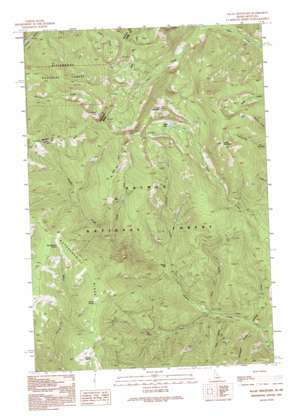
Allan Mountain Topo Map Idaho
To zoom in, hover over the map of Allan Mountain
USGS Topo Quad 45114e1 - 1:24,000 scale
| Topo Map Name: | Allan Mountain |
| USGS Topo Quad ID: | 45114e1 |
| Print Size: | ca. 21 1/4" wide x 27" high |
| Southeast Coordinates: | 45.5° N latitude / 114° W longitude |
| Map Center Coordinates: | 45.5625° N latitude / 114.0625° W longitude |
| U.S. States: | ID, MT |
| Filename: | o45114e1.jpg |
| Download Map JPG Image: | Allan Mountain topo map 1:24,000 scale |
| Map Type: | Topographic |
| Topo Series: | 7.5´ |
| Map Scale: | 1:24,000 |
| Source of Map Images: | United States Geological Survey (USGS) |
| Alternate Map Versions: |
Allan Mountain ID 1991, updated 1991 Download PDF Buy paper map Allan Mountain ID 1991, updated 1995 Download PDF Buy paper map Allan Mountain ID 1998, updated 2002 Download PDF Buy paper map Allan Mountain ID 2011 Download PDF Buy paper map Allan Mountain ID 2013 Download PDF Buy paper map |
| FStopo: | US Forest Service topo Allan Mountain is available: Download FStopo PDF Download FStopo TIF |
1:24,000 Topo Quads surrounding Allan Mountain
> Back to 45114e1 at 1:100,000 scale
> Back to 45114a1 at 1:250,000 scale
> Back to U.S. Topo Maps home
Allan Mountain topo map: Gazetteer
Allan Mountain: Bars
Salzer Bar elevation 1489m 4885′Allan Mountain: Flats
Ax Park elevation 2237m 7339′Allan Mountain: Lakes
Allan Lake elevation 2379m 7805′Burrell Lake elevation 2474m 8116′
Allan Mountain: Ridges
Butcherknife Ridge elevation 2382m 7814′Allan Mountain: Springs
Bear Wallow Spring elevation 2338m 7670′Indian Spring elevation 2274m 7460′
Tincup Spring elevation 2255m 7398′
Allan Mountain: Streams
Allan Creek elevation 1352m 4435′Ditch Creek elevation 1285m 4215′
Humbug Creek elevation 1314m 4311′
North Fork Hughes Creek elevation 1760m 5774′
Salzer Creek elevation 1474m 4835′
West Fork Hughes Creek elevation 1358m 4455′
Allan Mountain: Summits
Allan Mountain elevation 2785m 9137′Rocky Mountain elevation 2650m 8694′
Allan Mountain: Trails
Ax Park Way elevation 2473m 8113′Divide Trail elevation 2340m 7677′
Allan Mountain: Valleys
Gallagher Gulch elevation 1335m 4379′Klop Gulch elevation 1389m 4557′
Allan Mountain digital topo map on disk
Buy this Allan Mountain topo map showing relief, roads, GPS coordinates and other geographical features, as a high-resolution digital map file on DVD:


