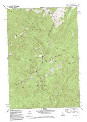
Blue Joint Topo Map Idaho
To zoom in, hover over the map of Blue Joint
USGS Topo Quad 45114e5 - 1:24,000 scale
| Topo Map Name: | Blue Joint |
| USGS Topo Quad ID: | 45114e5 |
| Print Size: | ca. 21 1/4" wide x 27" high |
| Southeast Coordinates: | 45.5° N latitude / 114.5° W longitude |
| Map Center Coordinates: | 45.5625° N latitude / 114.5625° W longitude |
| U.S. States: | ID, MT |
| Filename: | o45114e5.jpg |
| Download Map JPG Image: | Blue Joint topo map 1:24,000 scale |
| Map Type: | Topographic |
| Topo Series: | 7.5´ |
| Map Scale: | 1:24,000 |
| Source of Map Images: | United States Geological Survey (USGS) |
| Alternate Map Versions: |
Blue Joint ID 1962, updated 1963 Download PDF Buy paper map Blue Joint ID 1962, updated 1978 Download PDF Buy paper map Blue Joint ID 1991, updated 1994 Download PDF Buy paper map Blue Joint ID 1998, updated 2002 Download PDF Buy paper map Blue Joint ID 2011 Download PDF Buy paper map Blue Joint ID 2013 Download PDF Buy paper map |
| FStopo: | US Forest Service topo Blue Joint is available: Download FStopo PDF Download FStopo TIF |
1:24,000 Topo Quads surrounding Blue Joint
> Back to 45114e1 at 1:100,000 scale
> Back to 45114a1 at 1:250,000 scale
> Back to U.S. Topo Maps home
Blue Joint topo map: Gazetteer
Blue Joint: Flats
Storm Creek Flat elevation 1673m 5488′Blue Joint: Lakes
Line Lake elevation 2328m 7637′Reynolds Lake elevation 2301m 7549′
Blue Joint: Springs
Two Buck Spring elevation 2333m 7654′Blue Joint: Streams
East Fork Reynolds Creek elevation 1750m 5741′French Creek elevation 1842m 6043′
Line Creek elevation 1804m 5918′
Blue Joint: Summits
Blue Joint elevation 2614m 8576′Squaw Peak elevation 2626m 8615′
Blue Joint digital topo map on disk
Buy this Blue Joint topo map showing relief, roads, GPS coordinates and other geographical features, as a high-resolution digital map file on DVD:


