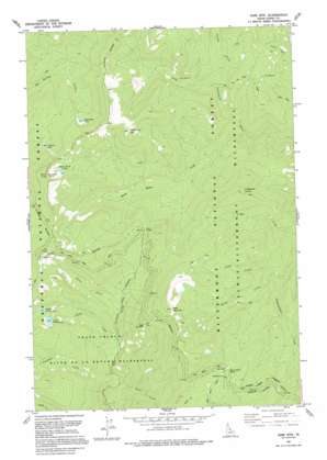
Sabe Mountain Topo Map Idaho
To zoom in, hover over the map of Sabe Mountain
USGS Topo Quad 45114f8 - 1:24,000 scale
| Topo Map Name: | Sabe Mountain |
| USGS Topo Quad ID: | 45114f8 |
| Print Size: | ca. 21 1/4" wide x 27" high |
| Southeast Coordinates: | 45.625° N latitude / 114.875° W longitude |
| Map Center Coordinates: | 45.6875° N latitude / 114.9375° W longitude |
| U.S. State: | ID |
| Filename: | o45114f8.jpg |
| Download Map JPG Image: | Sabe Mountain topo map 1:24,000 scale |
| Map Type: | Topographic |
| Topo Series: | 7.5´ |
| Map Scale: | 1:24,000 |
| Source of Map Images: | United States Geological Survey (USGS) |
| Alternate Map Versions: |
Sabe Mtn ID 1979, updated 1979 Download PDF Buy paper map Sabe Mountain ID 1991, updated 1995 Download PDF Buy paper map Sabe Mountain ID 1998, updated 2002 Download PDF Buy paper map Sabe Mountain ID 2011 Download PDF Buy paper map Sabe Mountain ID 2013 Download PDF Buy paper map |
| FStopo: | US Forest Service topo Sabe Mountain is available: Download FStopo PDF Download FStopo TIF |
1:24,000 Topo Quads surrounding Sabe Mountain
> Back to 45114e1 at 1:100,000 scale
> Back to 45114a1 at 1:250,000 scale
> Back to U.S. Topo Maps home
Sabe Mountain topo map: Gazetteer
Sabe Mountain: Capes
Sabe Vista Point elevation 2268m 7440′Sabe Mountain: Gaps
Dry Saddle elevation 2396m 7860′Horse Heaven Saddle elevation 2153m 7063′
Sabe Saddle elevation 2060m 6758′
Sabe Mountain: Lakes
Burnt Knob Lakes elevation 2255m 7398′Lower Trilby Lake elevation 2149m 7050′
Macarthur Lake elevation 2109m 6919′
Marsh Lake elevation 2264m 7427′
Middle Trilby Lake elevation 2149m 7050′
Stillman Lake elevation 2094m 6870′
Trilby Lakes elevation 2149m 7050′
Sabe Mountain: Streams
Basin Creek elevation 1858m 6095′Burnt Knob Creek elevation 1589m 5213′
Camp Creek elevation 1734m 5688′
Comb Creek elevation 1665m 5462′
Goodman Creek elevation 1682m 5518′
Throng Creek elevation 1696m 5564′
Twist Creek elevation 1634m 5360′
Sabe Mountain: Summits
Burnt Knob elevation 2487m 8159′Lodgepole Hump elevation 2206m 7237′
Sabe Mountain elevation 2507m 8225′
White Top Mountain elevation 2358m 7736′
Sabe Mountain: Trails
Old Nez Perce Indian Trail elevation 1637m 5370′Sabe Mountain digital topo map on disk
Buy this Sabe Mountain topo map showing relief, roads, GPS coordinates and other geographical features, as a high-resolution digital map file on DVD:


