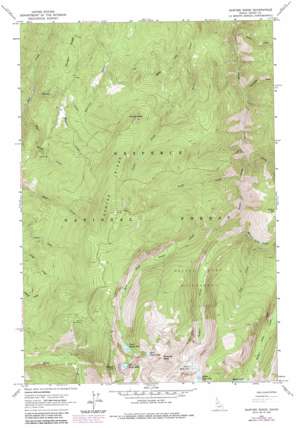
Sawyer Ridge Topo Map Idaho
To zoom in, hover over the map of Sawyer Ridge
USGS Topo Quad 45115f8 - 1:24,000 scale
| Topo Map Name: | Sawyer Ridge |
| USGS Topo Quad ID: | 45115f8 |
| Print Size: | ca. 21 1/4" wide x 27" high |
| Southeast Coordinates: | 45.625° N latitude / 115.875° W longitude |
| Map Center Coordinates: | 45.6875° N latitude / 115.9375° W longitude |
| U.S. State: | ID |
| Filename: | o45115f8.jpg |
| Download Map JPG Image: | Sawyer Ridge topo map 1:24,000 scale |
| Map Type: | Topographic |
| Topo Series: | 7.5´ |
| Map Scale: | 1:24,000 |
| Source of Map Images: | United States Geological Survey (USGS) |
| Alternate Map Versions: |
Sawyer Ridge ID 1963, updated 1965 Download PDF Buy paper map Sawyer Ridge ID 1963, updated 1978 Download PDF Buy paper map Sawyer Ridge ID 1963, updated 1987 Download PDF Buy paper map Sawyer Ridge ID 1995, updated 1999 Download PDF Buy paper map Sawyer Ridge ID 2011 Download PDF Buy paper map Sawyer Ridge ID 2013 Download PDF Buy paper map |
| FStopo: | US Forest Service topo Sawyer Ridge is available: Download FStopo PDF Download FStopo TIF |
1:24,000 Topo Quads surrounding Sawyer Ridge
> Back to 45115e1 at 1:100,000 scale
> Back to 45114a1 at 1:250,000 scale
> Back to U.S. Topo Maps home
Sawyer Ridge topo map: Gazetteer
Sawyer Ridge: Cliffs
Marble Point elevation 1806m 5925′Sawyer Ridge: Gaps
Mertary Creek Saddle elevation 1478m 4849′Merton Creek Saddle elevation 1482m 4862′
Sawyer Ridge: Lakes
East Gospel Lake elevation 2264m 7427′Gospel Lakes elevation 2196m 7204′
Knob Lakes elevation 2116m 6942′
Lower Gospel Lake elevation 2051m 6729′
Lower Knob Lake elevation 2018m 6620′
Middle Knob Lake elevation 2116m 6942′
Upper Gospel Lake elevation 2196m 7204′
Sawyer Ridge: Ridges
Sawyer Ridge elevation 2137m 7011′Sawyer Ridge: Streams
Fox Creek elevation 1461m 4793′Gospel Creek elevation 1202m 3943′
Marble Creek elevation 1318m 4324′
Merron Creek elevation 1425m 4675′
Merton Creek elevation 1258m 4127′
Moores Lake Creek elevation 1382m 4534′
Snoose Creek elevation 1038m 3405′
Sourdough Creek elevation 1118m 3667′
Swift Creek elevation 1243m 4078′
West Fork Gospel Creek elevation 1330m 4363′
Sawyer Ridge: Summits
Gospel Hill elevation 2474m 8116′Pyramid Point elevation 2551m 8369′
Sawyer Ridge digital topo map on disk
Buy this Sawyer Ridge topo map showing relief, roads, GPS coordinates and other geographical features, as a high-resolution digital map file on DVD:


