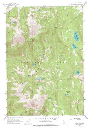
Hazard Lake Topo Map Idaho
To zoom in, hover over the map of Hazard Lake
USGS Topo Quad 45116b2 - 1:24,000 scale
| Topo Map Name: | Hazard Lake |
| USGS Topo Quad ID: | 45116b2 |
| Print Size: | ca. 21 1/4" wide x 27" high |
| Southeast Coordinates: | 45.125° N latitude / 116.125° W longitude |
| Map Center Coordinates: | 45.1875° N latitude / 116.1875° W longitude |
| U.S. State: | ID |
| Filename: | o45116b2.jpg |
| Download Map JPG Image: | Hazard Lake topo map 1:24,000 scale |
| Map Type: | Topographic |
| Topo Series: | 7.5´ |
| Map Scale: | 1:24,000 |
| Source of Map Images: | United States Geological Survey (USGS) |
| Alternate Map Versions: |
Hazard Lake ID 1963, updated 1965 Download PDF Buy paper map Hazard Lake ID 1963, updated 1978 Download PDF Buy paper map Hazard Lake ID 1963, updated 1978 Download PDF Buy paper map Hazard Lake ID 2004, updated 2007 Download PDF Buy paper map Hazard Lake ID 2011 Download PDF Buy paper map Hazard Lake ID 2013 Download PDF Buy paper map |
| FStopo: | US Forest Service topo Hazard Lake is available: Download FStopo PDF Download FStopo TIF |
1:24,000 Topo Quads surrounding Hazard Lake
> Back to 45116a1 at 1:100,000 scale
> Back to 45116a1 at 1:250,000 scale
> Back to U.S. Topo Maps home
Hazard Lake topo map: Gazetteer
Hazard Lake: Basins
Hard Creek Basin elevation 2096m 6876′Hazard Lake: Flats
Hard Creek Meadow elevation 1802m 5912′Hazard Lake: Lakes
Big Hazard Lake elevation 2125m 6971′Black Lake elevation 2180m 7152′
Buck Lake elevation 2099m 6886′
Coffee Cup Lake elevation 2232m 7322′
Disappointment Lake elevation 2094m 6870′
Eden Lake elevation 2306m 7565′
Frog Lake elevation 2288m 7506′
Grass Mountain Lakes elevation 2239m 7345′
Hard Creek Lake elevation 2263m 7424′
Hazard Lake elevation 2153m 7063′
Hidden Lake elevation 2106m 6909′
Lake Serene elevation 2165m 7103′
Lloyds Lake elevation 2092m 6863′
Morgan Lake elevation 1898m 6227′
Upper Hazard Lake elevation 2265m 7431′
Hazard Lake: Ranges
Grass Mountains elevation 2459m 8067′Hazard Lake: Streams
Big Dave Creek elevation 2049m 6722′Clayburn Creek elevation 1990m 6528′
Corral Creek elevation 1808m 5931′
East Fork Corral Creek elevation 1878m 6161′
Jacks Creek elevation 1535m 5036′
Vance Creek elevation 1717m 5633′
Warm Springs Creek elevation 1680m 5511′
Hazard Lake digital topo map on disk
Buy this Hazard Lake topo map showing relief, roads, GPS coordinates and other geographical features, as a high-resolution digital map file on DVD:


