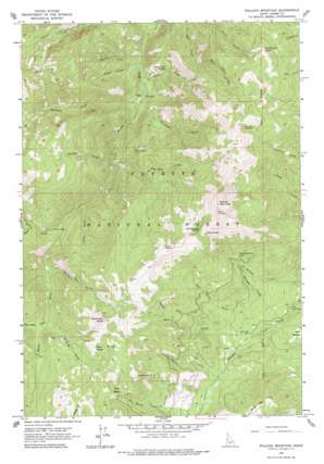
Pollock Mountain Topo Map Idaho
To zoom in, hover over the map of Pollock Mountain
USGS Topo Quad 45116b4 - 1:24,000 scale
| Topo Map Name: | Pollock Mountain |
| USGS Topo Quad ID: | 45116b4 |
| Print Size: | ca. 21 1/4" wide x 27" high |
| Southeast Coordinates: | 45.125° N latitude / 116.375° W longitude |
| Map Center Coordinates: | 45.1875° N latitude / 116.4375° W longitude |
| U.S. State: | ID |
| Filename: | o45116b4.jpg |
| Download Map JPG Image: | Pollock Mountain topo map 1:24,000 scale |
| Map Type: | Topographic |
| Topo Series: | 7.5´ |
| Map Scale: | 1:24,000 |
| Source of Map Images: | United States Geological Survey (USGS) |
| Alternate Map Versions: |
Pollock Mountain ID 1963, updated 1965 Download PDF Buy paper map Pollock Mountain ID 1963, updated 1977 Download PDF Buy paper map Pollock Mountain ID 1963, updated 1977 Download PDF Buy paper map Pollock Mountain ID 2004, updated 2007 Download PDF Buy paper map Pollock Mountain ID 2011 Download PDF Buy paper map Pollock Mountain ID 2013 Download PDF Buy paper map |
| FStopo: | US Forest Service topo Pollock Mountain is available: Download FStopo PDF Download FStopo TIF |
1:24,000 Topo Quads surrounding Pollock Mountain
> Back to 45116a1 at 1:100,000 scale
> Back to 45116a1 at 1:250,000 scale
> Back to U.S. Topo Maps home
Pollock Mountain topo map: Gazetteer
Pollock Mountain: Basins
Ant Basin elevation 1855m 6085′Bear Wallow elevation 1469m 4819′
Pollock Mountain: Cliffs
Lockwood Point elevation 2124m 6968′Pollock Mountain: Flats
Chokecherry Flat elevation 1732m 5682′Pollock Mountain: Gaps
Cold Springs Saddle elevation 2186m 7171′Pollock Mountain: Mines
Black Leopard Discovery Mine elevation 1696m 5564′Pollock Mountain: Parks
Rapid National Wild River elevation 1666m 5465′Pollock Mountain: Populated Places
Devils Ladder elevation 2246m 7368′Pollock Mountain: Springs
Cold Springs elevation 2148m 7047′Indian Springs elevation 2066m 6778′
Trail Creek Spring elevation 1403m 4603′
Pollock Mountain: Streams
Bull Horn Creek elevation 1425m 4675′Cabin Creek elevation 1437m 4714′
Cold Springs Creek elevation 1402m 4599′
Dentene Creek elevation 1401m 4596′
Echols Creek elevation 1599m 5246′
Fry Pan Creek elevation 1421m 4662′
Hell Creek elevation 1375m 4511′
Lake Fork elevation 1509m 4950′
Lonesome Creek elevation 1266m 4153′
Louise Creek elevation 1171m 3841′
Louse Creek elevation 1185m 3887′
North Fork Star Creek elevation 1564m 5131′
North Star Creek elevation 1600m 5249′
Paradise Creek elevation 1261m 4137′
Pollock Creek elevation 1379m 4524′
Sinking Creek elevation 1732m 5682′
Star Creek elevation 1427m 4681′
Trail Creek elevation 1228m 4028′
Twin Lakes Creek elevation 1733m 5685′
Pollock Mountain: Summits
Ant Butte elevation 2150m 7053′North Star Butte elevation 2256m 7401′
Pollock Mountain elevation 2423m 7949′
Pollock Mountain digital topo map on disk
Buy this Pollock Mountain topo map showing relief, roads, GPS coordinates and other geographical features, as a high-resolution digital map file on DVD:


