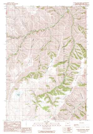
Clear Lake Ridge Topo Map Oregon
To zoom in, hover over the map of Clear Lake Ridge
USGS Topo Quad 45116d8 - 1:24,000 scale
| Topo Map Name: | Clear Lake Ridge |
| USGS Topo Quad ID: | 45116d8 |
| Print Size: | ca. 21 1/4" wide x 27" high |
| Southeast Coordinates: | 45.375° N latitude / 116.875° W longitude |
| Map Center Coordinates: | 45.4375° N latitude / 116.9375° W longitude |
| U.S. State: | OR |
| Filename: | o45116d8.jpg |
| Download Map JPG Image: | Clear Lake Ridge topo map 1:24,000 scale |
| Map Type: | Topographic |
| Topo Series: | 7.5´ |
| Map Scale: | 1:24,000 |
| Source of Map Images: | United States Geological Survey (USGS) |
| Alternate Map Versions: |
Clear Lake Ridge OR 1990, updated 1990 Download PDF Buy paper map Clear Lake Ridge OR 2011 Download PDF Buy paper map Clear Lake Ridge OR 2014 Download PDF Buy paper map |
| FStopo: | US Forest Service topo Clear Lake Ridge is available: Download FStopo PDF Download FStopo TIF |
1:24,000 Topo Quads surrounding Clear Lake Ridge
> Back to 45116a1 at 1:100,000 scale
> Back to 45116a1 at 1:250,000 scale
> Back to U.S. Topo Maps home
Clear Lake Ridge topo map: Gazetteer
Clear Lake Ridge: Lakes
Clear Lake elevation 1606m 5269′Dead Horse Lake elevation 1656m 5433′
Downey Lake elevation 1513m 4963′
Clear Lake Ridge: Ridges
Clear Lake Ridge elevation 1616m 5301′Devils Ridge elevation 1420m 4658′
Clear Lake Ridge: Streams
Branson Creek elevation 1005m 3297′Brigham Creek elevation 1080m 3543′
Butte Creek elevation 814m 2670′
Cold Creek elevation 951m 3120′
Dead Horse Creek elevation 975m 3198′
Fulton Creek elevation 852m 2795′
Hepburn Creek elevation 987m 3238′
Honeymoon Creek elevation 976m 3202′
Lightning Creek elevation 939m 3080′
Rattlesnake Creek elevation 1177m 3861′
Redrock Creek elevation 949m 3113′
Summit Creek elevation 1294m 4245′
Thorn Creek elevation 1209m 3966′
Tucker Creek elevation 968m 3175′
Clear Lake Ridge: Valleys
Bear Gulch elevation 795m 2608′Bird Canyon elevation 1253m 4110′
Cold Canyon elevation 976m 3202′
Devils Gulch elevation 868m 2847′
Downey Gulch elevation 1358m 4455′
Horse Gulch elevation 905m 2969′
Clear Lake Ridge digital topo map on disk
Buy this Clear Lake Ridge topo map showing relief, roads, GPS coordinates and other geographical features, as a high-resolution digital map file on DVD:


