John Day Mountain Topo Map Idaho
To zoom in, hover over the map of John Day Mountain
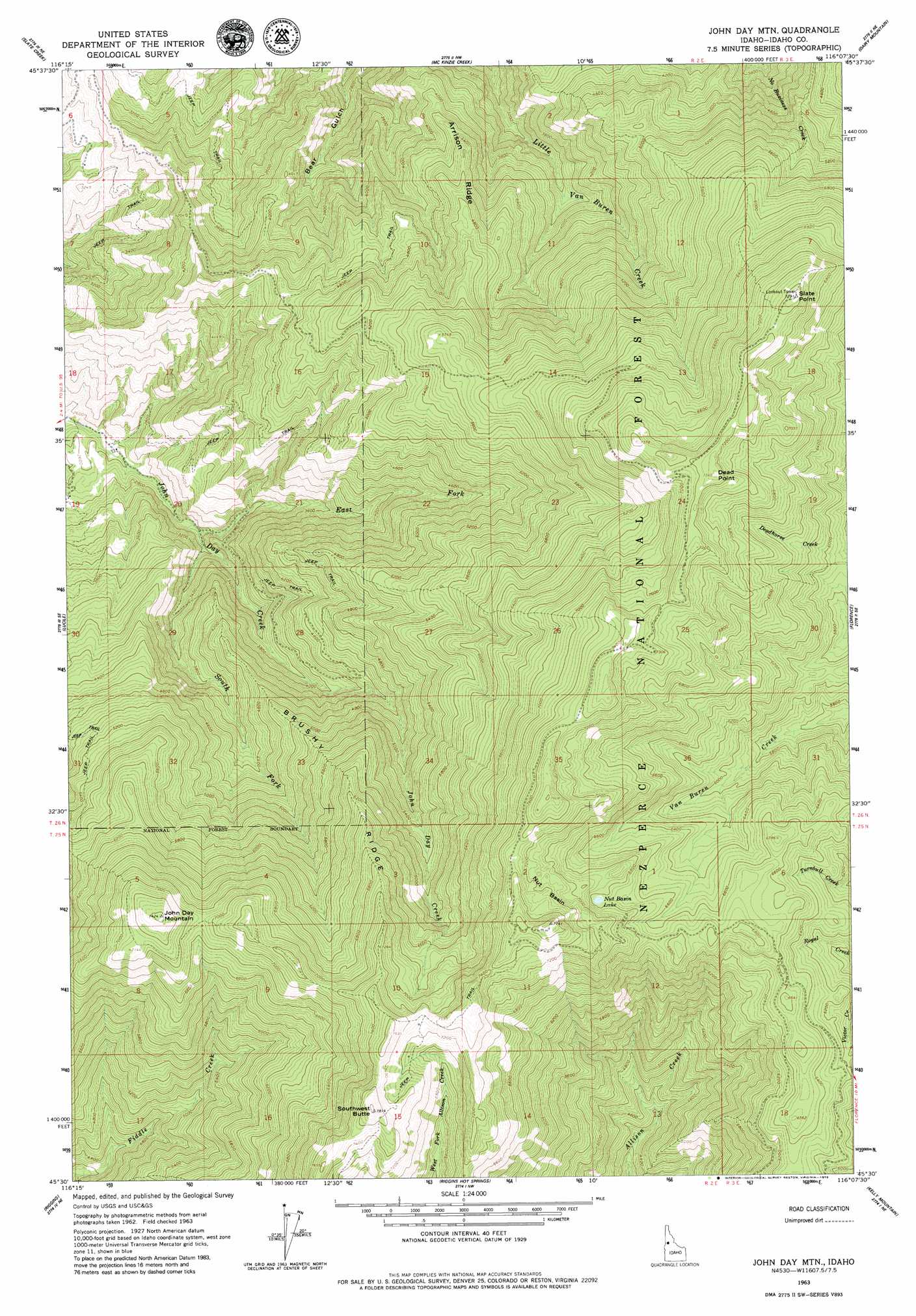
USGS Topo Quad 45116e2 - 1:24,000 scale
| Topo Map Name: | John Day Mountain |
| USGS Topo Quad ID: | 45116e2 |
| Print Size: | ca. 21 1/4" wide x 27" high |
| Southeast Coordinates: | 45.5° N latitude / 116.125° W longitude |
| Map Center Coordinates: | 45.5625° N latitude / 116.1875° W longitude |
| U.S. State: | ID |
| Filename: | o45116e2.jpg |
| Download Map JPG Image: | John Day Mountain topo map 1:24,000 scale |
| Map Type: | Topographic |
| Topo Series: | 7.5´ |
| Map Scale: | 1:24,000 |
| Source of Map Images: | United States Geological Survey (USGS) |
| Alternate Map Versions: |
John Day Mtn ID 1963, updated 1964 Download PDF Buy paper map John Day Mtn ID 1963, updated 1979 Download PDF Buy paper map John Day Mountain ID 1995, updated 1999 Download PDF Buy paper map John Day Mountain ID 2011 Download PDF Buy paper map John Day Mountain ID 2013 Download PDF Buy paper map |
| FStopo: | US Forest Service topo John Day Mountain is available: Download FStopo PDF Download FStopo TIF |
1:24,000 Topo Quads surrounding John Day Mountain
Joseph |
White Bird |
White Bird Hill |
Goodwin Meadows |
Hungry Ridge |
Grave Point |
Slate Creek |
Mckinzie Creek |
Dairy Mountain |
Sawyer Ridge |
Kirkwood Creek |
Lucile |
John Day Mountain |
Florence |
Hanover Mountain |
Kessler Creek |
Riggins |
Riggins Hot Springs |
Kelly Mountain |
Carey Dome |
Heavens Gate |
Pollock |
Patrick Butte |
Hershey Point |
Burgdorf |
> Back to 45116e1 at 1:100,000 scale
> Back to 45116a1 at 1:250,000 scale
> Back to U.S. Topo Maps home
John Day Mountain topo map: Gazetteer
John Day Mountain: Basins
Nut Basin elevation 2190m 7185′John Day Mountain: Lakes
Nut Basin Lake elevation 2070m 6791′John Day Mountain: Ridges
Arrison Ridge elevation 1369m 4491′Brushy Ridge elevation 1873m 6145′
John Day Mountain: Springs
Martin Spring elevation 2123m 6965′John Day Mountain: Streams
East Fork John Day Creek elevation 885m 2903′South Fork John Day Creek elevation 932m 3057′
John Day Mountain: Summits
Dead Point elevation 2244m 7362′John Day Mountain elevation 2262m 7421′
Slate Point elevation 2220m 7283′
Southwest Butte elevation 2360m 7742′
John Day Mountain digital topo map on disk
Buy this John Day Mountain topo map showing relief, roads, GPS coordinates and other geographical features, as a high-resolution digital map file on DVD: