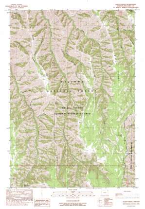
Sleepy Ridge Topo Map Oregon
To zoom in, hover over the map of Sleepy Ridge
USGS Topo Quad 45116e6 - 1:24,000 scale
| Topo Map Name: | Sleepy Ridge |
| USGS Topo Quad ID: | 45116e6 |
| Print Size: | ca. 21 1/4" wide x 27" high |
| Southeast Coordinates: | 45.5° N latitude / 116.625° W longitude |
| Map Center Coordinates: | 45.5625° N latitude / 116.6875° W longitude |
| U.S. State: | OR |
| Filename: | o45116e6.jpg |
| Download Map JPG Image: | Sleepy Ridge topo map 1:24,000 scale |
| Map Type: | Topographic |
| Topo Series: | 7.5´ |
| Map Scale: | 1:24,000 |
| Source of Map Images: | United States Geological Survey (USGS) |
| Alternate Map Versions: |
Sleepy Ridge OR 1990, updated 1990 Download PDF Buy paper map Sleepy Ridge OR 2011 Download PDF Buy paper map Sleepy Ridge OR 2014 Download PDF Buy paper map |
| FStopo: | US Forest Service topo Sleepy Ridge is available: Download FStopo PDF Download FStopo TIF |
1:24,000 Topo Quads surrounding Sleepy Ridge
> Back to 45116e1 at 1:100,000 scale
> Back to 45116a1 at 1:250,000 scale
> Back to U.S. Topo Maps home
Sleepy Ridge topo map: Gazetteer
Sleepy Ridge: Flats
Sour Apple Flat elevation 1943m 6374′Sleepy Ridge: Ridges
Haas Ridge elevation 1648m 5406′Jakey Ridge elevation 1786m 5859′
Sleepy Ridge elevation 1614m 5295′
Windy Ridge elevation 1833m 6013′
Sleepy Ridge: Streams
Hangover Creek elevation 918m 3011′Last Chance Creek elevation 1324m 4343′
Medicine Creek elevation 1032m 3385′
Wing Creek elevation 1349m 4425′
Sleepy Ridge: Summits
Bald Knob elevation 1835m 6020′Grassy Knoll elevation 1991m 6532′
Sleepy Ridge: Valleys
Hays Gulch elevation 997m 3270′Rheumatiz Gulch elevation 985m 3231′
Saddle Gulch elevation 1055m 3461′
Windy Hell Canyon elevation 1044m 3425′
Sleepy Ridge digital topo map on disk
Buy this Sleepy Ridge topo map showing relief, roads, GPS coordinates and other geographical features, as a high-resolution digital map file on DVD:


