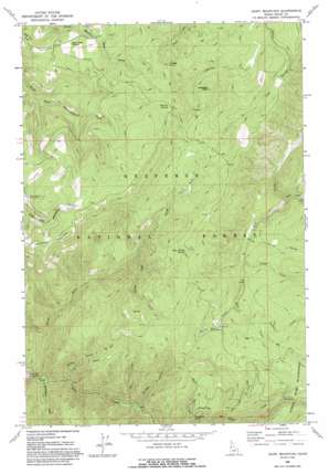
Dairy Mountain Topo Map Idaho
To zoom in, hover over the map of Dairy Mountain
USGS Topo Quad 45116f1 - 1:24,000 scale
| Topo Map Name: | Dairy Mountain |
| USGS Topo Quad ID: | 45116f1 |
| Print Size: | ca. 21 1/4" wide x 27" high |
| Southeast Coordinates: | 45.625° N latitude / 116° W longitude |
| Map Center Coordinates: | 45.6875° N latitude / 116.0625° W longitude |
| U.S. State: | ID |
| Filename: | o45116f1.jpg |
| Download Map JPG Image: | Dairy Mountain topo map 1:24,000 scale |
| Map Type: | Topographic |
| Topo Series: | 7.5´ |
| Map Scale: | 1:24,000 |
| Source of Map Images: | United States Geological Survey (USGS) |
| Alternate Map Versions: |
Dairy Mountain ID 1963, updated 1965 Download PDF Buy paper map Dairy Mountain ID 1963, updated 1993 Download PDF Buy paper map Dairy Mountain ID 1995, updated 1999 Download PDF Buy paper map Dairy Mountain ID 2011 Download PDF Buy paper map Dairy Mountain ID 2013 Download PDF Buy paper map |
| FStopo: | US Forest Service topo Dairy Mountain is available: Download FStopo PDF Download FStopo TIF |
1:24,000 Topo Quads surrounding Dairy Mountain
> Back to 45116e1 at 1:100,000 scale
> Back to 45116a1 at 1:250,000 scale
> Back to U.S. Topo Maps home
Dairy Mountain topo map: Gazetteer
Dairy Mountain: Cliffs
Buckshot Point elevation 1318m 4324′Dairy Mountain: Flats
Willow Flat elevation 1350m 4429′Dairy Mountain: Gaps
Cold Springs Saddle elevation 1704m 5590′Dairy Mountain: Springs
Fenn Cabin Spring elevation 1552m 5091′Peter Ready Spring elevation 1779m 5836′
Pig Foot Spring elevation 1815m 5954′
Dairy Mountain: Streams
Adams Creek elevation 1529m 5016′Asbestos Creek elevation 1540m 5052′
Basin Creek elevation 1135m 3723′
Black George Creek elevation 1279m 4196′
Camp Creek elevation 1456m 4776′
Corral Creek elevation 1427m 4681′
Dry Lake Creek elevation 1296m 4251′
Hepner Creek elevation 1550m 5085′
Hunt Creek elevation 1376m 4514′
Lee Creek elevation 1010m 3313′
North Fork Slate Creek elevation 866m 2841′
Peter Ready Creek elevation 1389m 4557′
Trough Creek elevation 1033m 3389′
Waterspout Creek elevation 871m 2857′
Willow Creek elevation 896m 2939′
Dairy Mountain: Summits
Asbestos Peak elevation 1771m 5810′Dairy Mountain elevation 1967m 6453′
Jungle Point elevation 1779m 5836′
Dairy Mountain digital topo map on disk
Buy this Dairy Mountain topo map showing relief, roads, GPS coordinates and other geographical features, as a high-resolution digital map file on DVD:


