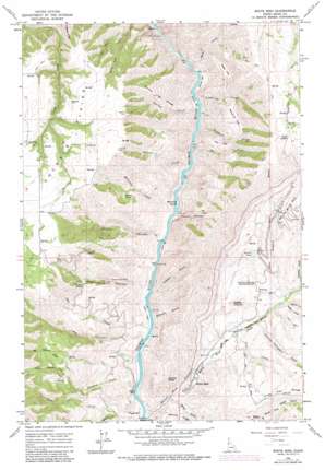
White Bird Topo Map Idaho
To zoom in, hover over the map of White Bird
USGS Topo Quad 45116g3 - 1:24,000 scale
| Topo Map Name: | White Bird |
| USGS Topo Quad ID: | 45116g3 |
| Print Size: | ca. 21 1/4" wide x 27" high |
| Southeast Coordinates: | 45.75° N latitude / 116.25° W longitude |
| Map Center Coordinates: | 45.8125° N latitude / 116.3125° W longitude |
| U.S. State: | ID |
| Filename: | o45116g3.jpg |
| Download Map JPG Image: | White Bird topo map 1:24,000 scale |
| Map Type: | Topographic |
| Topo Series: | 7.5´ |
| Map Scale: | 1:24,000 |
| Source of Map Images: | United States Geological Survey (USGS) |
| Alternate Map Versions: |
White Bird ID 1963, updated 1965 Download PDF Buy paper map White Bird ID 1963, updated 1982 Download PDF Buy paper map White Bird ID 1995, updated 1999 Download PDF Buy paper map White Bird ID 2010 Download PDF Buy paper map White Bird ID 2013 Download PDF Buy paper map |
| FStopo: | US Forest Service topo White Bird is available: Download FStopo PDF Download FStopo TIF |
1:24,000 Topo Quads surrounding White Bird
> Back to 45116e1 at 1:100,000 scale
> Back to 45116a1 at 1:250,000 scale
> Back to U.S. Topo Maps home
White Bird topo map: Gazetteer
White Bird: Bars
Lyons Bar elevation 427m 1400′Shorts Bar elevation 415m 1361′
Swartz Bar elevation 426m 1397′
White Bird: Basins
Boulder Basin elevation 946m 3103′White Bird: Flats
Doumecq Plains elevation 1295m 4248′Lee Flat elevation 738m 2421′
Pealy Flat elevation 821m 2693′
Woodruff Flat elevation 896m 2939′
White Bird: Gaps
Rape Saddle elevation 1339m 4393′White Bird: Islands
Big Foot Island elevation 425m 1394′White Bird: Mines
Diamond Drill Mine elevation 704m 2309′White Bird: Parks
Nezperce Indian War Historical Monument elevation 633m 2076′White Bird: Populated Places
Canfield elevation 1286m 4219′Copperville elevation 449m 1473′
Whipsaw Saddle elevation 1045m 3428′
White Bird elevation 482m 1581′
White Bird: Post Offices
Manuel Post Office (historical) elevation 660m 2165′White Bird: Reservoirs
Swartz Pond elevation 740m 2427′White Bird: Ridges
Hewed Log Ridge elevation 1068m 3503′White Bird: Streams
Big Hammer Creek elevation 827m 2713′Chapman Creek elevation 597m 1958′
Gregory Creek elevation 541m 1774′
Hammer Creek elevation 448m 1469′
Lee Creek elevation 421m 1381′
Lightning Creek elevation 416m 1364′
Little Hammer Creek elevation 827m 2713′
McCulley Creek elevation 436m 1430′
Otto Creek elevation 441m 1446′
Price Creek elevation 522m 1712′
Sharkey Creek elevation 463m 1519′
Sheep Creek elevation 424m 1391′
White Bird Creek elevation 436m 1430′
Wildcat Creek elevation 426m 1397′
White Bird: Summits
Battle Ground elevation 687m 2253′Giants Nose elevation 893m 2929′
The Knob elevation 921m 3021′
White Bird: Valleys
Baker Gulch elevation 463m 1519′Big Canyon elevation 438m 1437′
Diamond Drill Canyon elevation 443m 1453′
Hagen Draw elevation 567m 1860′
Jimmie Thompson Draw elevation 548m 1797′
Magpie Gulch elevation 574m 1883′
McCully Gulch elevation 428m 1404′
North Fork Baker Gulch elevation 650m 2132′
Owens Gulch elevation 430m 1410′
Shorty Canyon elevation 432m 1417′
Shut-in Canyon elevation 426m 1397′
Soards Gulch elevation 431m 1414′
Warden Gulch elevation 596m 1955′
White Bird Canyon elevation 438m 1437′
Woodruff Gulch elevation 419m 1374′
White Bird digital topo map on disk
Buy this White Bird topo map showing relief, roads, GPS coordinates and other geographical features, as a high-resolution digital map file on DVD:


