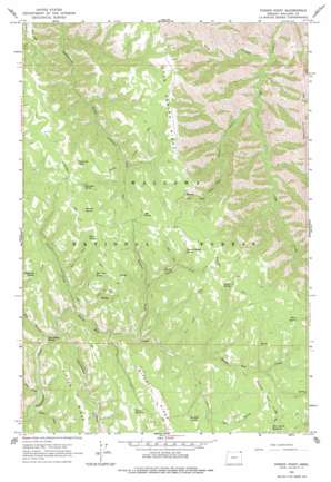
Poison Point Topo Map Oregon
To zoom in, hover over the map of Poison Point
USGS Topo Quad 45116g8 - 1:24,000 scale
| Topo Map Name: | Poison Point |
| USGS Topo Quad ID: | 45116g8 |
| Print Size: | ca. 21 1/4" wide x 27" high |
| Southeast Coordinates: | 45.75° N latitude / 116.875° W longitude |
| Map Center Coordinates: | 45.8125° N latitude / 116.9375° W longitude |
| U.S. State: | OR |
| Filename: | o45116g8.jpg |
| Download Map JPG Image: | Poison Point topo map 1:24,000 scale |
| Map Type: | Topographic |
| Topo Series: | 7.5´ |
| Map Scale: | 1:24,000 |
| Source of Map Images: | United States Geological Survey (USGS) |
| Alternate Map Versions: |
Poison Point OR 1963, updated 1965 Download PDF Buy paper map Poison Point OR 1963, updated 1978 Download PDF Buy paper map Poison Point OR 2011 Download PDF Buy paper map Poison Point OR 2014 Download PDF Buy paper map |
| FStopo: | US Forest Service topo Poison Point is available: Download FStopo PDF Download FStopo TIF |
1:24,000 Topo Quads surrounding Poison Point
> Back to 45116e1 at 1:100,000 scale
> Back to 45116a1 at 1:250,000 scale
> Back to U.S. Topo Maps home
Poison Point topo map: Gazetteer
Poison Point: Reservoirs
Cutout Reservoir elevation 1438m 4717′Rice Corral Reservoir elevation 1522m 4993′
Poison Point: Ridges
Bear Ridge elevation 1591m 5219′Crooked Pine Ridge elevation 1523m 4996′
Hilton Ridge elevation 1388m 4553′
Poison Point: Springs
Bear Paw Spring elevation 1518m 4980′Big Canyon Spring elevation 1217m 3992′
Box Spring elevation 1587m 5206′
Burn Spring elevation 1560m 5118′
Fairchild Spring elevation 1574m 5164′
Hideaway Spring elevation 1440m 4724′
Howard Spring elevation 1575m 5167′
Mitchell Spring elevation 1430m 4691′
Poison Spring elevation 1571m 5154′
Summit Ridge Spring elevation 1596m 5236′
Yandall Spring elevation 1585m 5200′
Poison Point: Streams
Billy Creek elevation 1183m 3881′Devils Run Creek elevation 1212m 3976′
Five Points Creek elevation 778m 2552′
Poison Creek elevation 1243m 4078′
South Fork Summit Creek elevation 1390m 4560′
Summit Creek elevation 1297m 4255′
Poison Point: Summits
Fairchild Point elevation 1626m 5334′Poison Point elevation 1648m 5406′
Poison Point: Trails
Cook Creek Trail elevation 1417m 4648′Cottonwood Creek Trail elevation 1466m 4809′
Howard Cutoff Trail elevation 1605m 5265′
Poison Point: Valleys
Big Canyon elevation 1208m 3963′Hilton Gulch elevation 1177m 3861′
TNT Gulch elevation 1357m 4452′
Wild Canyon elevation 648m 2125′
Poison Point digital topo map on disk
Buy this Poison Point topo map showing relief, roads, GPS coordinates and other geographical features, as a high-resolution digital map file on DVD:


