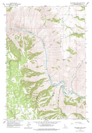
Moughmer Point Topo Map Idaho
To zoom in, hover over the map of Moughmer Point
USGS Topo Quad 45116h4 - 1:24,000 scale
| Topo Map Name: | Moughmer Point |
| USGS Topo Quad ID: | 45116h4 |
| Print Size: | ca. 21 1/4" wide x 27" high |
| Southeast Coordinates: | 45.875° N latitude / 116.375° W longitude |
| Map Center Coordinates: | 45.9375° N latitude / 116.4375° W longitude |
| U.S. State: | ID |
| Filename: | o45116h4.jpg |
| Download Map JPG Image: | Moughmer Point topo map 1:24,000 scale |
| Map Type: | Topographic |
| Topo Series: | 7.5´ |
| Map Scale: | 1:24,000 |
| Source of Map Images: | United States Geological Survey (USGS) |
| Alternate Map Versions: |
Moughmer Point ID 1963, updated 1965 Download PDF Buy paper map Moughmer Point ID 1963, updated 1977 Download PDF Buy paper map Moughmer Point ID 2010 Download PDF Buy paper map Moughmer Point ID 2013 Download PDF Buy paper map |
| FStopo: | US Forest Service topo Moughmer Point is available: Download FStopo PDF Download FStopo TIF |
1:24,000 Topo Quads surrounding Moughmer Point
> Back to 45116e1 at 1:100,000 scale
> Back to 45116a1 at 1:250,000 scale
> Back to U.S. Topo Maps home
Moughmer Point topo map: Gazetteer
Moughmer Point: Bars
American Bar elevation 394m 1292′Cooper Bar elevation 411m 1348′
Moughmer Point: Basins
The Basin elevation 471m 1545′Moughmer Point: Bridges
Rice Creek Bridge elevation 392m 1286′Moughmer Point: Cliffs
Bug Slope elevation 505m 1656′Moughmer Point elevation 1270m 4166′
Moughmer Point: Ridges
Bingman Ridge elevation 1287m 4222′Moughmer Ridge elevation 1246m 4087′
Price Ridge elevation 1083m 3553′
Moughmer Point: Streams
Center Creek elevation 557m 1827′First Creek elevation 391m 1282′
Packers Creek elevation 379m 1243′
Rice Creek elevation 400m 1312′
Rock Creek elevation 397m 1302′
Second Creek elevation 388m 1272′
Telcher Creek elevation 375m 1230′
Wickiup Creek elevation 386m 1266′
Moughmer Point: Valleys
Andrews Canyon elevation 400m 1312′Maple Canyon elevation 402m 1318′
Rocky Canyon elevation 403m 1322′
Moughmer Point digital topo map on disk
Buy this Moughmer Point topo map showing relief, roads, GPS coordinates and other geographical features, as a high-resolution digital map file on DVD:


