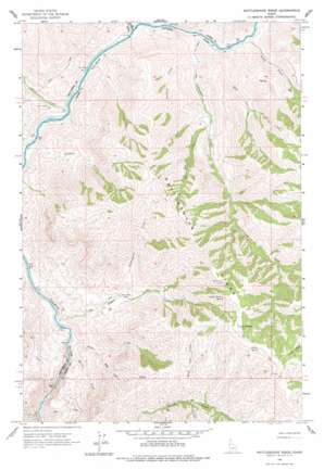
Rattlesnake Ridge Topo Map Idaho
To zoom in, hover over the map of Rattlesnake Ridge
USGS Topo Quad 45116h6 - 1:24,000 scale
| Topo Map Name: | Rattlesnake Ridge |
| USGS Topo Quad ID: | 45116h6 |
| Print Size: | ca. 21 1/4" wide x 27" high |
| Southeast Coordinates: | 45.875° N latitude / 116.625° W longitude |
| Map Center Coordinates: | 45.9375° N latitude / 116.6875° W longitude |
| U.S. State: | ID |
| Filename: | o45116h6.jpg |
| Download Map JPG Image: | Rattlesnake Ridge topo map 1:24,000 scale |
| Map Type: | Topographic |
| Topo Series: | 7.5´ |
| Map Scale: | 1:24,000 |
| Source of Map Images: | United States Geological Survey (USGS) |
| Alternate Map Versions: |
Rattlesnake Ridge ID 1963, updated 1965 Download PDF Buy paper map Rattlesnake Ridge ID 1963, updated 1977 Download PDF Buy paper map Rattlesnake Ridge ID 2010 Download PDF Buy paper map Rattlesnake Ridge ID 2013 Download PDF Buy paper map |
| FStopo: | US Forest Service topo Rattlesnake Ridge is available: Download FStopo PDF Download FStopo TIF |
1:24,000 Topo Quads surrounding Rattlesnake Ridge
> Back to 45116e1 at 1:100,000 scale
> Back to 45116a1 at 1:250,000 scale
> Back to U.S. Topo Maps home
Rattlesnake Ridge topo map: Gazetteer
Rattlesnake Ridge: Ridges
Rattlesnake Ridge elevation 1341m 4399′Rattlesnake Ridge: Springs
Camp Thomas Spring elevation 1397m 4583′Thorn Spring elevation 1405m 4609′
Rattlesnake Ridge: Streams
Billy Creek elevation 329m 1079′China Creek elevation 316m 1036′
Cottonwood Creek elevation 329m 1079′
Deer Creek elevation 327m 1072′
Dry Creek elevation 333m 1092′
Eagle Creek elevation 324m 1062′
Flynn Creek elevation 300m 984′
Fourmile Creek elevation 860m 2821′
Guthery Creek elevation 406m 1332′
Miller Creek elevation 314m 1030′
Pot Creek elevation 293m 961′
Rattlesnake Creek elevation 560m 1837′
Right Fork Rock Creek elevation 475m 1558′
Rock Creek elevation 299m 980′
Skeleton Creek elevation 310m 1017′
Slick Ear Creek elevation 547m 1794′
Wild Cow Creek elevation 865m 2837′
Rattlesnake Ridge digital topo map on disk
Buy this Rattlesnake Ridge topo map showing relief, roads, GPS coordinates and other geographical features, as a high-resolution digital map file on DVD:


