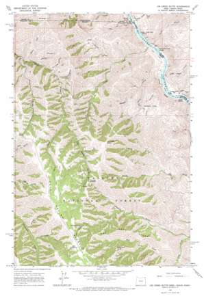
Jim Creek Butte Topo Map Oregon
To zoom in, hover over the map of Jim Creek Butte
USGS Topo Quad 45116h8 - 1:24,000 scale
| Topo Map Name: | Jim Creek Butte |
| USGS Topo Quad ID: | 45116h8 |
| Print Size: | ca. 21 1/4" wide x 27" high |
| Southeast Coordinates: | 45.875° N latitude / 116.875° W longitude |
| Map Center Coordinates: | 45.9375° N latitude / 116.9375° W longitude |
| U.S. States: | OR, ID, WA |
| Filename: | o45116h8.jpg |
| Download Map JPG Image: | Jim Creek Butte topo map 1:24,000 scale |
| Map Type: | Topographic |
| Topo Series: | 7.5´ |
| Map Scale: | 1:24,000 |
| Source of Map Images: | United States Geological Survey (USGS) |
| Alternate Map Versions: |
Jim Creek Butte OR 1963, updated 1965 Download PDF Buy paper map Jim Creek Butte OR 1963, updated 1973 Download PDF Buy paper map Jim Creek Butte OR 2011 Download PDF Buy paper map Jim Creek Butte OR 2014 Download PDF Buy paper map |
| FStopo: | US Forest Service topo Jim Creek Butte is available: Download FStopo PDF Download FStopo TIF |
1:24,000 Topo Quads surrounding Jim Creek Butte
> Back to 45116e1 at 1:100,000 scale
> Back to 45116a1 at 1:250,000 scale
> Back to U.S. Topo Maps home
Jim Creek Butte topo map: Gazetteer
Jim Creek Butte: Bars
Cougar Rapids Bar elevation 273m 895′Jim Creek Butte: Basins
Baldwin Area elevation 660m 2165′Jim Creek Butte: Gaps
Downey Saddle elevation 1420m 4658′Jim Creek Butte: Islands
Cochran Islands elevation 264m 866′Jim Creek Butte: Lakes
Frog Pond elevation 1668m 5472′Jim Creek Butte: Rapids
Cochran Rapids elevation 264m 866′Cochran Rapids elevation 264m 866′
Cougar Rapids elevation 265m 869′
Lower Cache Creek Rapids elevation 262m 859′
Lower Cache Creek Rapids elevation 262m 859′
Lower Cochran Rapids elevation 264m 866′
McDuff Rapids elevation 260m 853′
McDuff Rapids elevation 260m 853′
Upper Cache Creek Rapids elevation 263m 862′
Upper Cache Creek Rapids elevation 263m 862′
Upper Cochran Rapids elevation 264m 866′
Jim Creek Butte: Ridges
Cold Spring Ridge elevation 1435m 4708′Dry Creek Ridge elevation 1351m 4432′
Jim Creek Butte: Springs
Cold Spring elevation 1610m 5282′Old Cold Spring elevation 1456m 4776′
Jim Creek Butte: Streams
Big Cougar Creek elevation 269m 882′Cabin Creek elevation 1144m 3753′
Cache Creek elevation 263m 862′
China Garden Creek elevation 265m 869′
Cold Spring Creek elevation 1138m 3733′
Coon Creek elevation 270m 885′
Deadhorse Creek elevation 1032m 3385′
Dry Creek elevation 526m 1725′
Garden Creek elevation 264m 866′
Jack Lowery Creek elevation 493m 1617′
Little Cougar Creek elevation 270m 885′
North Fork Jim Creek elevation 588m 1929′
Sheldon Creek elevation 816m 2677′
South Fork Jim Creek elevation 588m 1929′
Spencer Creek elevation 538m 1765′
State Line Creek elevation 264m 866′
Jim Creek Butte: Summits
Frog Pond Butte elevation 1358m 4455′Jim Creek Butte elevation 1542m 5059′
Lent Butte elevation 1480m 4855′
Mount Wilson elevation 1493m 4898′
Jim Creek Butte: Valleys
Cave Gulch elevation 269m 882′Chaffer Canyon elevation 853m 2798′
Coon Hollow elevation 264m 866′
Downey Gulch elevation 424m 1391′
Fir Tree Canyon elevation 936m 3070′
Gailord Gulch elevation 1277m 4189′
Jenny Corral Gulch elevation 991m 3251′
Road Gulch elevation 771m 2529′
Smooth Gulch elevation 987m 3238′
Jim Creek Butte digital topo map on disk
Buy this Jim Creek Butte topo map showing relief, roads, GPS coordinates and other geographical features, as a high-resolution digital map file on DVD:


