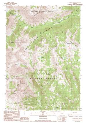
Cornucopia Topo Map Oregon
To zoom in, hover over the map of Cornucopia
USGS Topo Quad 45117a2 - 1:24,000 scale
| Topo Map Name: | Cornucopia |
| USGS Topo Quad ID: | 45117a2 |
| Print Size: | ca. 21 1/4" wide x 27" high |
| Southeast Coordinates: | 45° N latitude / 117.125° W longitude |
| Map Center Coordinates: | 45.0625° N latitude / 117.1875° W longitude |
| U.S. State: | OR |
| Filename: | o45117a2.jpg |
| Download Map JPG Image: | Cornucopia topo map 1:24,000 scale |
| Map Type: | Topographic |
| Topo Series: | 7.5´ |
| Map Scale: | 1:24,000 |
| Source of Map Images: | United States Geological Survey (USGS) |
| Alternate Map Versions: |
Cornucopia OR 1990, updated 1990 Download PDF Buy paper map Cornucopia OR 2011 Download PDF Buy paper map Cornucopia OR 2014 Download PDF Buy paper map |
| FStopo: | US Forest Service topo Cornucopia is available: Download FStopo PDF Download FStopo TIF |
1:24,000 Topo Quads surrounding Cornucopia
> Back to 45117a1 at 1:100,000 scale
> Back to 45116a1 at 1:250,000 scale
> Back to U.S. Topo Maps home
Cornucopia topo map: Gazetteer
Cornucopia: Basins
Norway Basin elevation 2120m 6955′Stein Basin elevation 2167m 7109′
Cornucopia: Dams
Clear Creek Dam elevation 2108m 6916′East Lakes Dam elevation 2216m 7270′
Mehlhorn-Bassett Dam elevation 2087m 6847′
Cornucopia: Falls
East Fork Falls elevation 1877m 6158′Cornucopia: Flats
Boner Flat elevation 2144m 7034′Schneider Meadows elevation 1714m 5623′
Cornucopia: Lakes
Soldier Lake elevation 2158m 7080′Cornucopia: Mines
Cornucopia Mines elevation 1785m 5856′Coulter Tunnel elevation 1472m 4829′
Last Chance Mine elevation 2110m 6922′
Queen Mine elevation 1630m 5347′
Queen of the West Mine elevation 2361m 7746′
Cornucopia: Populated Places
Cornucopia elevation 1444m 4737′Cornucopia: Post Offices
Cornucopia Post Office (historical) elevation 1444m 4737′Cornucopia: Reservoirs
East Lakes Reservoir elevation 2216m 7270′Mehlhorn Reservoir elevation 2087m 6847′
Red Mountain Reservoir elevation 2292m 7519′
Steele Reservoir elevation 2096m 6876′
Cornucopia: Streams
Bear Creek elevation 1697m 5567′Blue Creek elevation 1759m 5770′
Cliff Creek elevation 1799m 5902′
East Fork Clear Creek elevation 1796m 5892′
East Fork Pine Creek elevation 1485m 4872′
Elk Creek elevation 1584m 5196′
Fall Creek elevation 1512m 4960′
Fly Creek elevation 1788m 5866′
Jim Fisk Creek elevation 1561m 5121′
Middle Fork Pine Creek elevation 1594m 5229′
North Fork Imnaha River elevation 1625m 5331′
Norway Creek elevation 1678m 5505′
Panter Creek elevation 1388m 4553′
Simmons Creek elevation 1659m 5442′
Soldier Creek elevation 1662m 5452′
South Fork Imnaha River elevation 1623m 5324′
West Fork Clear Creek elevation 1796m 5892′
West Fork Pine Creek elevation 1594m 5229′
Cornucopia: Summits
Cornucopia Peak elevation 2597m 8520′Granite Mountain elevation 2760m 9055′
Marble Mountain elevation 2668m 8753′
Red Mountain elevation 2907m 9537′
Sugarloaf Mountain elevation 2422m 7946′
Cornucopia: Trails
Kettle Creek Trail elevation 1948m 6391′Cornucopia digital topo map on disk
Buy this Cornucopia topo map showing relief, roads, GPS coordinates and other geographical features, as a high-resolution digital map file on DVD:


