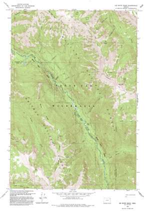
Jim White Ridge Topo Map Oregon
To zoom in, hover over the map of Jim White Ridge
USGS Topo Quad 45117c5 - 1:24,000 scale
| Topo Map Name: | Jim White Ridge |
| USGS Topo Quad ID: | 45117c5 |
| Print Size: | ca. 21 1/4" wide x 27" high |
| Southeast Coordinates: | 45.25° N latitude / 117.5° W longitude |
| Map Center Coordinates: | 45.3125° N latitude / 117.5625° W longitude |
| U.S. State: | OR |
| Filename: | o45117c5.jpg |
| Download Map JPG Image: | Jim White Ridge topo map 1:24,000 scale |
| Map Type: | Topographic |
| Topo Series: | 7.5´ |
| Map Scale: | 1:24,000 |
| Source of Map Images: | United States Geological Survey (USGS) |
| Alternate Map Versions: |
Jim White Ridge OR 1966, updated 1967 Download PDF Buy paper map Jim White Ridge OR 1966, updated 1985 Download PDF Buy paper map Jim White Ridge OR 1993, updated 1993 Download PDF Buy paper map Jim White Ridge OR 2011 Download PDF Buy paper map Jim White Ridge OR 2014 Download PDF Buy paper map |
| FStopo: | US Forest Service topo Jim White Ridge is available: Download FStopo PDF Download FStopo TIF |
1:24,000 Topo Quads surrounding Jim White Ridge
> Back to 45117a1 at 1:100,000 scale
> Back to 45116a1 at 1:250,000 scale
> Back to U.S. Topo Maps home
Jim White Ridge topo map: Gazetteer
Jim White Ridge: Basins
Blowout Basin elevation 2014m 6607′Corral Basin elevation 2107m 6912′
Miner Basin elevation 2140m 7020′
Saddle Basin elevation 2128m 6981′
Twin Basin elevation 2060m 6758′
Jim White Ridge: Falls
Minam Falls elevation 1201m 3940′Jim White Ridge: Flats
Big Burn elevation 1236m 4055′Jim White Ridge: Ridges
Jim White Ridge elevation 2268m 7440′Young Ridge elevation 2137m 7011′
Jim White Ridge: Springs
Mud Spring elevation 2221m 7286′Jim White Ridge: Streams
Blowout Basin Creek elevation 1483m 4865′Chaparral Creek elevation 1119m 3671′
Garwood Creek elevation 1168m 3832′
Granite Creek elevation 1706m 5597′
Jerry Creek elevation 1259m 4130′
Jungle Creek elevation 1676m 5498′
Little Pot Creek elevation 1262m 4140′
Miner Basin Creek elevation 1620m 5314′
North Minam River elevation 1270m 4166′
Sturgill Creek elevation 1359m 4458′
Threemile Creek elevation 1229m 4032′
Twin Basin Creek elevation 1555m 5101′
Vaughn Creek elevation 1887m 6190′
Wallowa Creek elevation 1115m 3658′
Whoopee Creek elevation 1147m 3763′
Jim White Ridge: Summits
Bald Mountain elevation 2408m 7900′Jim White Ridge: Trails
Salt Trail elevation 2114m 6935′Washboard Trail elevation 2204m 7230′
Jim White Ridge digital topo map on disk
Buy this Jim White Ridge topo map showing relief, roads, GPS coordinates and other geographical features, as a high-resolution digital map file on DVD:


