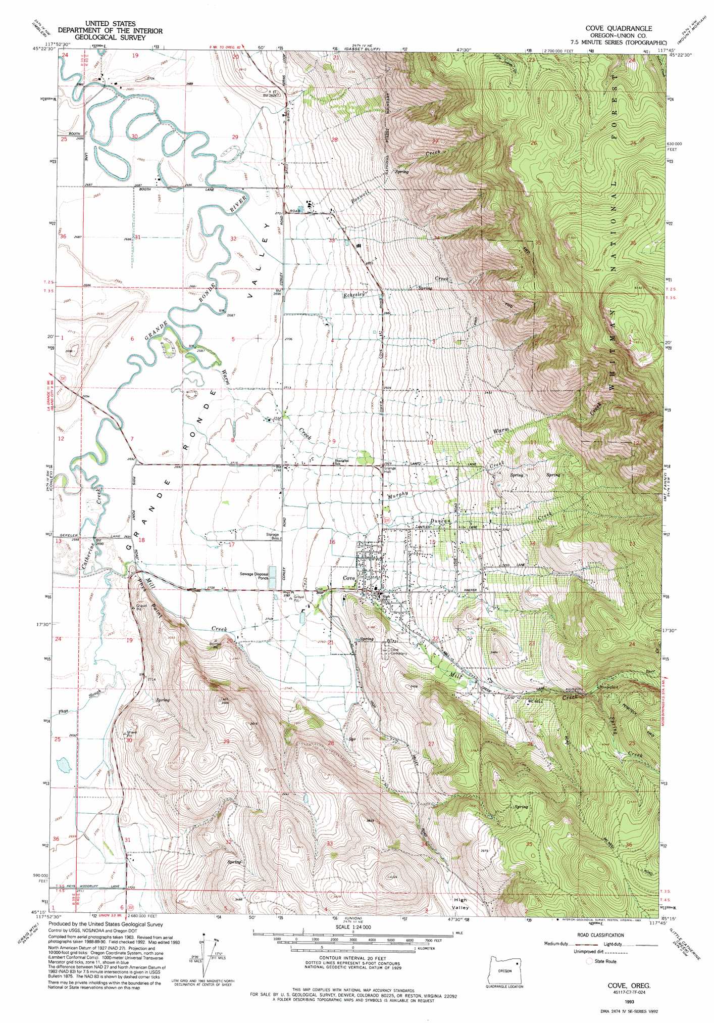
Cove Topo Map Oregon
To zoom in, hover over the map of Cove
USGS Topo Quad 45117c7 - 1:24,000 scale
| Topo Map Name: | Cove |
| USGS Topo Quad ID: | 45117c7 |
| Print Size: | ca. 21 1/4" wide x 27" high |
| Southeast Coordinates: | 45.25° N latitude / 117.75° W longitude |
| Map Center Coordinates: | 45.3125° N latitude / 117.8125° W longitude |
| U.S. State: | OR |
| Filename: | o45117c7.jpg |
| Download Map JPG Image: | Cove topo map 1:24,000 scale |
| Map Type: | Topographic |
| Topo Series: | 7.5´ |
| Map Scale: | 1:24,000 |
| Source of Map Images: | United States Geological Survey (USGS) |
| Alternate Map Versions: |
Cove OR 1965, updated 1967 Download PDF Buy paper map Cove OR 1965, updated 1985 Download PDF Buy paper map Cove OR 1993, updated 1993 Download PDF Buy paper map Cove OR 2011 Download PDF Buy paper map Cove OR 2014 Download PDF Buy paper map |
| FStopo: | US Forest Service topo Cove is available: Download FStopo PDF Download FStopo TIF |
1:24,000 Topo Quads surrounding Cove
Sanderson Spring |
Elgin |
Cricket Flat |
Minam |
Wallowa |
Summerville |
Imbler |
Gassett Bluff |
Mount Moriah |
Fox Point |
La Grande |
Conley |
Cove |
Mount Fanny |
Jim White Ridge |
Glass Hill |
Craig Mountain |
Union |
Little Catherine Creek |
China Cap |
Tucker Flat |
North Powder |
Telocaset |
Medical Springs |
Flagstaff Butte |
> Back to 45117a1 at 1:100,000 scale
> Back to 45116a1 at 1:250,000 scale
> Back to U.S. Topo Maps home
Cove topo map: Gazetteer
Cove: Dams
Elmer Dam Number Four elevation 817m 2680′Elmer Dam Number Three elevation 817m 2680′
Cove: Populated Places
Cove elevation 892m 2926′Cove: Post Offices
Cove Post Office elevation 892m 2926′Cove: Reservoirs
Elmers Reservoir 1 elevation 818m 2683′Elmers Reservoir 2 elevation 818m 2683′
Elmers Reservoir 3 elevation 817m 2680′
Elmers Reservoir 4 elevation 817m 2680′
Hohstadt Reservoir elevation 971m 3185′
Cove: Ridges
Phys Point elevation 868m 2847′Cove: Springs
Cove Hot Springs elevation 877m 2877′Wagner Springs elevation 830m 2723′
Cove: Streams
Bobington Branch elevation 895m 2936′Boswell Creek elevation 828m 2716′
Catherine Creek elevation 818m 2683′
Deer Creek elevation 1111m 3645′
Duncan Creek elevation 820m 2690′
Eckesley Creek elevation 839m 2752′
Hulick Branch elevation 895m 2936′
Mill Creek elevation 819m 2687′
Millard Branch elevation 946m 3103′
Murphy Creek elevation 820m 2690′
Phys Slough elevation 821m 2693′
Spring Creek elevation 1081m 3546′
Warm Creek elevation 818m 2683′
Cove digital topo map on disk
Buy this Cove topo map showing relief, roads, GPS coordinates and other geographical features, as a high-resolution digital map file on DVD: