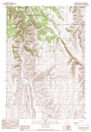
Elk Mountain Topo Map Oregon
To zoom in, hover over the map of Elk Mountain
USGS Topo Quad 45117e2 - 1:24,000 scale
| Topo Map Name: | Elk Mountain |
| USGS Topo Quad ID: | 45117e2 |
| Print Size: | ca. 21 1/4" wide x 27" high |
| Southeast Coordinates: | 45.5° N latitude / 117.125° W longitude |
| Map Center Coordinates: | 45.5625° N latitude / 117.1875° W longitude |
| U.S. State: | OR |
| Filename: | o45117e2.jpg |
| Download Map JPG Image: | Elk Mountain topo map 1:24,000 scale |
| Map Type: | Topographic |
| Topo Series: | 7.5´ |
| Map Scale: | 1:24,000 |
| Source of Map Images: | United States Geological Survey (USGS) |
| Alternate Map Versions: |
Elk Mountain OR 1990, updated 1990 Download PDF Buy paper map Elk Mountain OR 2011 Download PDF Buy paper map Elk Mountain OR 2014 Download PDF Buy paper map |
| FStopo: | US Forest Service topo Elk Mountain is available: Download FStopo PDF Download FStopo TIF |
1:24,000 Topo Quads surrounding Elk Mountain
> Back to 45117e1 at 1:100,000 scale
> Back to 45116a1 at 1:250,000 scale
> Back to U.S. Topo Maps home
Elk Mountain topo map: Gazetteer
Elk Mountain: Streams
Beaver Creek elevation 1206m 3956′Spring Creek elevation 1212m 3976′
Elk Mountain: Summits
Elk Mountain elevation 1560m 5118′Elk Mountain: Valleys
Arkansas Hollow elevation 1196m 3923′Baker Canyon elevation 1273m 4176′
Slack Canyon elevation 1171m 3841′
Elk Mountain digital topo map on disk
Buy this Elk Mountain topo map showing relief, roads, GPS coordinates and other geographical features, as a high-resolution digital map file on DVD:


