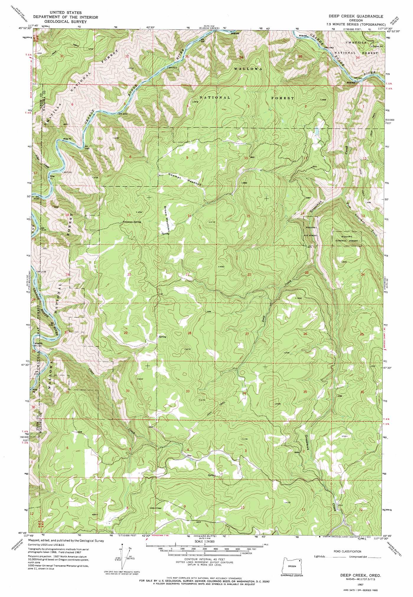
Deep Creek Topo Map Oregon
To zoom in, hover over the map of Deep Creek
USGS Topo Quad 45117g6 - 1:24,000 scale
| Topo Map Name: | Deep Creek |
| USGS Topo Quad ID: | 45117g6 |
| Print Size: | ca. 21 1/4" wide x 27" high |
| Southeast Coordinates: | 45.75° N latitude / 117.625° W longitude |
| Map Center Coordinates: | 45.8125° N latitude / 117.6875° W longitude |
| U.S. State: | OR |
| Filename: | o45117g6.jpg |
| Download Map JPG Image: | Deep Creek topo map 1:24,000 scale |
| Map Type: | Topographic |
| Topo Series: | 7.5´ |
| Map Scale: | 1:24,000 |
| Source of Map Images: | United States Geological Survey (USGS) |
| Alternate Map Versions: |
Deep Creek OR 1967, updated 1971 Download PDF Buy paper map Deep Creek OR 1967, updated 1972 Download PDF Buy paper map Deep Creek OR 1967, updated 1983 Download PDF Buy paper map Deep Creek OR 1995, updated 1998 Download PDF Buy paper map Deep Creek OR 2011 Download PDF Buy paper map Deep Creek OR 2014 Download PDF Buy paper map |
| FStopo: | US Forest Service topo Deep Creek is available: Download FStopo PDF Download FStopo TIF |
1:24,000 Topo Quads surrounding Deep Creek
Deadman Peak |
Godman Spring |
Oregon Butte |
Diamond Peak |
Saddle Butte |
Bone Spring |
Wenaha Forks |
Elbow Creek |
Eden |
Troy |
Jubilee Lake |
Fry Meadow |
Deep Creek |
Promise |
Wood Butte |
Partridge Creek |
Rondowa |
Howard Butte |
Akers Butte |
Washboard Ridge |
Elgin |
Cricket Flat |
Minam |
Wallowa |
Evans |
> Back to 45117e1 at 1:100,000 scale
> Back to 45116a1 at 1:250,000 scale
> Back to U.S. Topo Maps home
Deep Creek topo map: Gazetteer
Deep Creek: Flats
Brown Meadows elevation 1251m 4104′Grove Meadow elevation 1238m 4061′
Newman Meadows elevation 1249m 4097′
Deep Creek: Parks
Grande Ronde Scenic Area elevation 1018m 3339′Minam State Park elevation 1068m 3503′
Deep Creek: Post Offices
Wenaka Post Office (historical) elevation 964m 3162′Deep Creek: Springs
Ferguson Spring elevation 1279m 4196′Deep Creek: Streams
Alder Creek elevation 643m 2109′Clear Creek elevation 664m 2178′
Deep Creek elevation 830m 2723′
East Grossman Creek elevation 695m 2280′
Grossman Creek elevation 589m 1932′
Deep Creek: Summits
Indian Point elevation 1157m 3795′Deep Creek digital topo map on disk
Buy this Deep Creek topo map showing relief, roads, GPS coordinates and other geographical features, as a high-resolution digital map file on DVD: