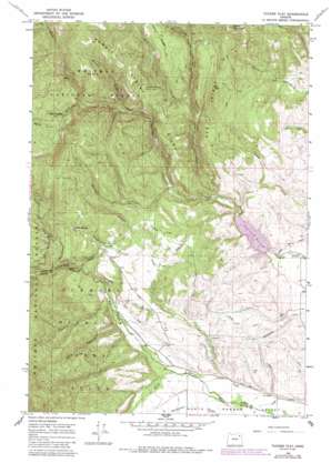
Tucker Flat Topo Map Oregon
To zoom in, hover over the map of Tucker Flat
USGS Topo Quad 45118a1 - 1:24,000 scale
| Topo Map Name: | Tucker Flat |
| USGS Topo Quad ID: | 45118a1 |
| Print Size: | ca. 21 1/4" wide x 27" high |
| Southeast Coordinates: | 45° N latitude / 118° W longitude |
| Map Center Coordinates: | 45.0625° N latitude / 118.0625° W longitude |
| U.S. State: | OR |
| Filename: | o45118a1.jpg |
| Download Map JPG Image: | Tucker Flat topo map 1:24,000 scale |
| Map Type: | Topographic |
| Topo Series: | 7.5´ |
| Map Scale: | 1:24,000 |
| Source of Map Images: | United States Geological Survey (USGS) |
| Alternate Map Versions: |
Tucker Flat OR 1965, updated 1967 Download PDF Buy paper map Tucker Flat OR 1965, updated 1985 Download PDF Buy paper map Tucker Flat OR 2011 Download PDF Buy paper map Tucker Flat OR 2014 Download PDF Buy paper map |
| FStopo: | US Forest Service topo Tucker Flat is available: Download FStopo PDF Download FStopo TIF |
1:24,000 Topo Quads surrounding Tucker Flat
> Back to 45118a1 at 1:100,000 scale
> Back to 45118a1 at 1:250,000 scale
> Back to U.S. Topo Maps home
Tucker Flat topo map: Gazetteer
Tucker Flat: Canals
Carnes Ditch elevation 1166m 3825′Coughanour Ditch elevation 1108m 3635′
Lone Pine Ditch elevation 1134m 3720′
Tucker Flat: Dams
Wolf Creek Dam elevation 1126m 3694′Tucker Flat: Flats
Tucker Flat elevation 1279m 4196′Tucker Flat: Parks
Elkhorn Wildlife Area elevation 1257m 4124′Pilcher Creek Recreation Area elevation 1221m 4005′
Tucker Flat: Reservoirs
Henrys Reservoir elevation 1080m 3543′Huddleston Reservoir elevation 1256m 4120′
Wolf Creek Reservoir elevation 1126m 3694′
Tucker Flat: Ridges
Red Ridge elevation 1489m 4885′Summit Spring Ridge elevation 1636m 5367′
Tucker Flat: Springs
Bowman Spring elevation 1210m 3969′Goff Spring elevation 1216m 3989′
King Spring elevation 1568m 5144′
Summit Spring elevation 1453m 4767′
Tucker Flat: Streams
Anthony Creek elevation 1078m 3536′Baker Creek elevation 1114m 3654′
Clear Creek elevation 1146m 3759′
Daley Creek elevation 1206m 3956′
Dutch Creek elevation 1237m 4058′
East Fork Clear Creek elevation 1265m 4150′
Metzler Creek elevation 1297m 4255′
North Fork Wolf Creek elevation 1342m 4402′
Pilcher Creek elevation 1057m 3467′
Roger Creek elevation 1142m 3746′
Third Creek elevation 1393m 4570′
West Fork Clear Creek elevation 1271m 4169′
Tucker Flat: Summits
Shaw Mountain elevation 1661m 5449′Tucker Flat: Valleys
Anthony Gorge elevation 1243m 4078′Dark Canyon elevation 1114m 3654′
Shingle Gulch elevation 1201m 3940′
Tucker Flat digital topo map on disk
Buy this Tucker Flat topo map showing relief, roads, GPS coordinates and other geographical features, as a high-resolution digital map file on DVD:


