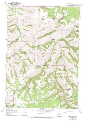
Bassey Creek Topo Map Oregon
To zoom in, hover over the map of Bassey Creek
USGS Topo Quad 45118d5 - 1:24,000 scale
| Topo Map Name: | Bassey Creek |
| USGS Topo Quad ID: | 45118d5 |
| Print Size: | ca. 21 1/4" wide x 27" high |
| Southeast Coordinates: | 45.375° N latitude / 118.5° W longitude |
| Map Center Coordinates: | 45.4375° N latitude / 118.5625° W longitude |
| U.S. State: | OR |
| Filename: | o45118d5.jpg |
| Download Map JPG Image: | Bassey Creek topo map 1:24,000 scale |
| Map Type: | Topographic |
| Topo Series: | 7.5´ |
| Map Scale: | 1:24,000 |
| Source of Map Images: | United States Geological Survey (USGS) |
| Alternate Map Versions: |
Bassey Creek OR 1967, updated 1969 Download PDF Buy paper map Bassey Creek OR 1996, updated 1998 Download PDF Buy paper map Bassey Creek OR 2011 Download PDF Buy paper map Bassey Creek OR 2014 Download PDF Buy paper map |
| FStopo: | US Forest Service topo Bassey Creek is available: Download FStopo PDF Download FStopo TIF |
1:24,000 Topo Quads surrounding Bassey Creek
> Back to 45118a1 at 1:100,000 scale
> Back to 45118a1 at 1:250,000 scale
> Back to U.S. Topo Maps home
Bassey Creek topo map: Gazetteer
Bassey Creek: Populated Places
McKay elevation 586m 1922′Bassey Creek: Post Offices
McKay Post Office (historical) elevation 586m 1922′Bassey Creek: Ridges
Baldy Ridge elevation 1295m 4248′Johnson Ridge elevation 1294m 4245′
Bassey Creek: Springs
Beers Spring elevation 1277m 4189′Elder Spring elevation 1033m 3389′
Green Spring elevation 1139m 3736′
Marlin Spring elevation 1138m 3733′
Mathis Spring elevation 1288m 4225′
Spino Spring elevation 883m 2896′
Watkins Spring elevation 1231m 4038′
Bassey Creek: Streams
Bassey Creek elevation 703m 2306′Bear Creek elevation 1004m 3293′
Johnson Creek elevation 708m 2322′
Lake Creek elevation 721m 2365′
Little Johnson Creek elevation 766m 2513′
Little Rail Creek elevation 714m 2342′
Rail Creek elevation 654m 2145′
Salt Creek elevation 737m 2417′
Sevenmile Creek elevation 619m 2030′
Bassey Creek: Summits
Storm Mountain elevation 1355m 4445′Bassey Creek: Valleys
Coyote Canyon elevation 821m 2693′Denson Canyon elevation 606m 1988′
First Canyon elevation 669m 2194′
Gibson Canyon elevation 654m 2145′
Green Spring Draw elevation 739m 2424′
Lawler Canyon elevation 586m 1922′
Red Spring Canyon elevation 735m 2411′
Wood Hollow elevation 641m 2103′
Bassey Creek digital topo map on disk
Buy this Bassey Creek topo map showing relief, roads, GPS coordinates and other geographical features, as a high-resolution digital map file on DVD:


