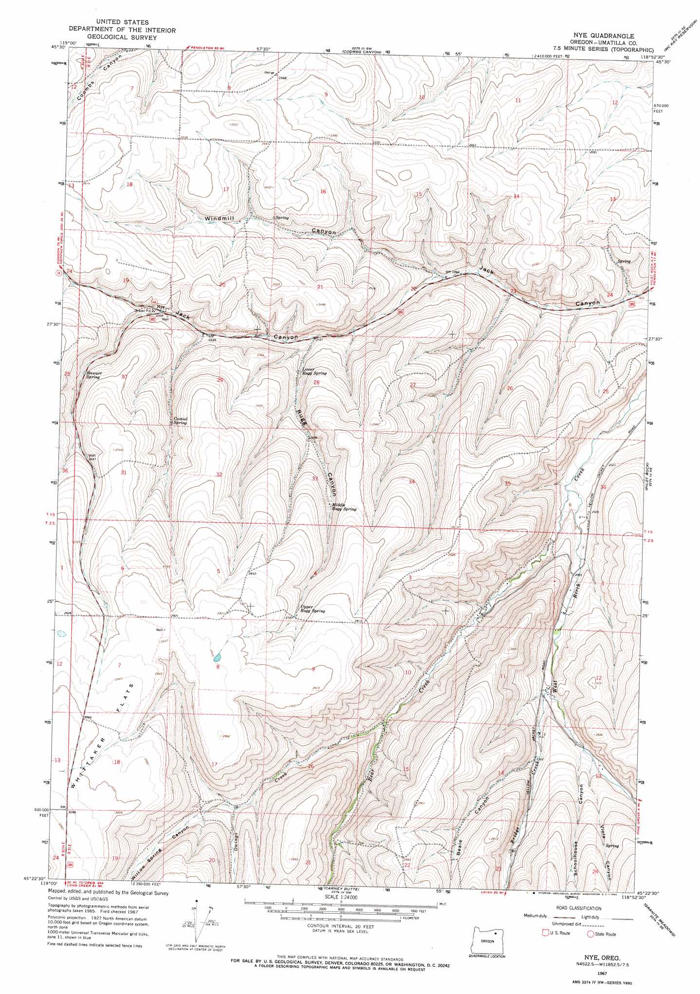
Nye Topo Map Oregon
To zoom in, hover over the map of Nye
USGS Topo Quad 45118d8 - 1:24,000 scale
| Topo Map Name: | Nye |
| USGS Topo Quad ID: | 45118d8 |
| Print Size: | ca. 21 1/4" wide x 27" high |
| Southeast Coordinates: | 45.375° N latitude / 118.875° W longitude |
| Map Center Coordinates: | 45.4375° N latitude / 118.9375° W longitude |
| U.S. State: | OR |
| Filename: | o45118d8.jpg |
| Download Map JPG Image: | Nye topo map 1:24,000 scale |
| Map Type: | Topographic |
| Topo Series: | 7.5´ |
| Map Scale: | 1:24,000 |
| Source of Map Images: | United States Geological Survey (USGS) |
| Alternate Map Versions: |
Nye OR 1967, updated 1969 Download PDF Buy paper map Nye OR 2011 Download PDF Buy paper map Nye OR 2014 Download PDF Buy paper map |
1:24,000 Topo Quads surrounding Nye
Echo |
Nolin |
Barnhart |
Pendleton |
Mission |
Echo Sw |
Echo Se |
Coombs Canyon |
Mckay Reservoir |
Table Rock |
Franklin Hill |
Vinson |
Nye |
Pilot Rock |
Sevenmile Creek |
Hoodlum Canyon |
Gurdane |
Carney Butte |
Granite Meadows |
Tamarack Gulch |
Matlock Prairie |
Sugarbowl Creek |
Ukiah |
Owens Butte |
Lehman Springs |
> Back to 45118a1 at 1:100,000 scale
> Back to 45118a1 at 1:250,000 scale
> Back to U.S. Topo Maps home
Nye topo map: Gazetteer
Nye: Dams
Bill Howell Dam elevation 668m 2191′Nye: Flats
Whittaker Flats elevation 911m 2988′Nye: Populated Places
Nye elevation 704m 2309′Nye: Post Offices
Nye Post Office (historical) elevation 704m 2309′Nye: Reservoirs
Bill Howell Reservoir elevation 668m 2191′Nye: Springs
Casteel Spring elevation 739m 2424′Lower Rugg Spring elevation 672m 2204′
Middle Rugg Spring elevation 754m 2473′
Stewart Spring elevation 754m 2473′
Upper Rugg Spring elevation 830m 2723′
Nye: Streams
Bear Creek elevation 598m 1961′Bridge Creek elevation 672m 2204′
Owings Creek elevation 676m 2217′
Nye: Valleys
Beale Canyon elevation 704m 2309′Rugg Canyon elevation 648m 2125′
Schoolhouse Canyon elevation 704m 2309′
Viola Canyon elevation 707m 2319′
Willow Spring Canyon elevation 746m 2447′
Windmill Canyon elevation 602m 1975′
Nye digital topo map on disk
Buy this Nye topo map showing relief, roads, GPS coordinates and other geographical features, as a high-resolution digital map file on DVD: