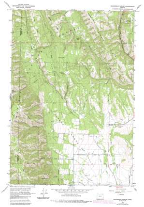
Sanderson Spring Topo Map Oregon
To zoom in, hover over the map of Sanderson Spring
USGS Topo Quad 45118e1 - 1:24,000 scale
| Topo Map Name: | Sanderson Spring |
| USGS Topo Quad ID: | 45118e1 |
| Print Size: | ca. 21 1/4" wide x 27" high |
| Southeast Coordinates: | 45.5° N latitude / 118° W longitude |
| Map Center Coordinates: | 45.5625° N latitude / 118.0625° W longitude |
| U.S. State: | OR |
| Filename: | o45118e1.jpg |
| Download Map JPG Image: | Sanderson Spring topo map 1:24,000 scale |
| Map Type: | Topographic |
| Topo Series: | 7.5´ |
| Map Scale: | 1:24,000 |
| Source of Map Images: | United States Geological Survey (USGS) |
| Alternate Map Versions: |
Sanderson Spring OR 1963, updated 1965 Download PDF Buy paper map Sanderson Spring OR 1963, updated 1982 Download PDF Buy paper map Sanderson Spring OR 1963, updated 1984 Download PDF Buy paper map Sanderson Spring OR 1995, updated 1998 Download PDF Buy paper map Sanderson Spring OR 2011 Download PDF Buy paper map Sanderson Spring OR 2014 Download PDF Buy paper map |
| FStopo: | US Forest Service topo Sanderson Spring is available: Download FStopo PDF Download FStopo TIF |
1:24,000 Topo Quads surrounding Sanderson Spring
> Back to 45118e1 at 1:100,000 scale
> Back to 45118a1 at 1:250,000 scale
> Back to U.S. Topo Maps home
Sanderson Spring topo map: Gazetteer
Sanderson Spring: Gaps
Big Saddle elevation 1412m 4632′Sanderson Spring: Ranges
Blue Mountains elevation 833m 2732′Sanderson Spring: Reservoirs
Feik Reservoirs elevation 878m 2880′Jarvis Ponds elevation 891m 2923′
Sanderson Spring: Ridges
Finley Ridge elevation 1230m 4035′Indian Point elevation 1118m 3667′
Middle Ridge elevation 1343m 4406′
Pfefferkorn Ridge elevation 1532m 5026′
Rocky Ridge elevation 1281m 4202′
Smith Ridge elevation 1612m 5288′
Sanderson Spring: Springs
McMillen Spring elevation 1163m 3815′Sanderson Spring elevation 883m 2896′
Sanderson Spring: Streams
Bailey Creek elevation 937m 3074′East Phillips Creek elevation 1071m 3513′
Finley Creek elevation 1049m 3441′
Lanman Creek elevation 869m 2851′
Little Dry Creek elevation 857m 2811′
Spring Creek elevation 878m 2880′
Strapping Creek elevation 943m 3093′
Sanderson Spring: Summits
Huckleberry Mountain elevation 1489m 4885′Sanderson Spring: Valleys
Colt Canyon elevation 974m 3195′Glenn Canyon elevation 1072m 3517′
Jack Canyon elevation 946m 3103′
Moonshine Canyon elevation 1002m 3287′
Pfefferkorn Canyon elevation 981m 3218′
Smith Canyon elevation 1103m 3618′
Sanderson Spring digital topo map on disk
Buy this Sanderson Spring topo map showing relief, roads, GPS coordinates and other geographical features, as a high-resolution digital map file on DVD:


